Dawu Chengguanzhen geodata
Dawu Chengguanzhen (Hubei) is a seat of a third-order administrative division; located in China in Asia/Shanghai (GMT+8) time zone. In our database, there are 1268 cities with bigger population. Compared to other cities in China, 59% of cities are located further ↓South; 50.6% of cities are located further →East and 52.7% of cities have higher elevation than Dawu Chengguanzhen. Note1


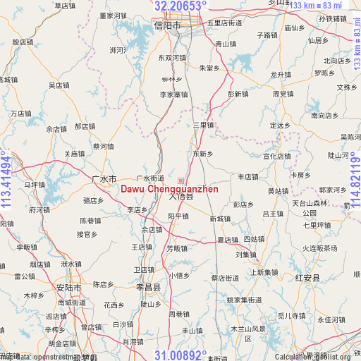
Dawu Chengguanzhen GPS coordinates[2]
31° 36' 34.74" North, 114° 7' 5.016" East
| Map corner | latitude | longitude |
|---|---|---|
| Upper-left | 32.20653°, | 113.41494° |
| Center: | 31.60965°, | 114.11806° |
| Lower-right: | 31.00892°, | 114.82119° |
| Map W x H: | 133.2×133.2 km | = 82.8×82.8mi |
| max Lat: | 53.31946° ⇑41% North |
| Dawu Chengguanzhen: | 31.60965° |
| min Lat: | ⇓59% South 18.22056° |
| min Long | Dawu Chengguanz | max Long |
| 75.07348° | 114.11806° | 134.28917° |
| W 49.4%⇐ | ⇒50.6% E |
Elevation
Elevation of Dawu Chengguanzhen is 145 m = 476 ft, and this is 339.8 m = 1115 ft below average elevation for this country.
| Max E: |
5622 m = 18445 ft | 52.7% |
| Avg. | 484.8 m = 1591 ft | |
| Dawu Chengguanzhen | 145 m = 476 ft | |
Min E: |
-3 m = -10 ft | 47.3% |
See also: China elevation on elevation.city.
Geographical zone
Dawu Chengguanzhen is located in North temperate zone (between Tropic of Cancer and the Arctic Circle). Distance of this Northern Tropic circle is 908.7 km =564.6 mi to South.| Distance of | km | miles | from Dawu Chengguanzhen |
|---|---|---|---|
| North Pole | 6492.4 | 4034.2 | to North |
| Arctic Circle | 3886.5 | 2415 | to North |
| Tropic Cancer | 908.7 | 564.6 | to South |
| Equator | 3514.7 | 2183.9 | to South |


Nearby cities:
15 places around Dawu Chengguanzhen: (largest is in red/bold)
• Baolin
24.5 km =15.2 mi,  286°
286°
• Daxin
12.8 km =8 mi,  15°
15°
• Dongxin
13.4 km =8.3 mi,  39°
39°
• Fangfan
24.5 km =15.2 mi,  183°
183°
• Fengdian
24.9 km =15.5 mi,  86°
86°
• Gaodian
10.7 km =6.6 mi,  102°
102°
• Guangshui
11.4 km =7.1 mi,  275°
275°
• Pengdian
24.7 km =15.3 mi,  109°
109°
• Sanlicheng
22.7 km =14.1 mi, 20°
• Shili
22.5 km =14 mi,  271°
271°
• Taiping
25.4 km =15.8 mi,  227°
227°
• Wushengguan
10.5 km =6.5 mi,  315°
315°
• Xincheng
19.5 km =12.1 mi,  134°
134°
• Yangping
12.4 km =7.7 mi, 183°
• Yangzhai
16.2 km =10.1 mi,  216°
216°
Sources, notices
• [Note1] Compared only with cities in China existing in our database
• [Src1] Map data: © OpenStreetMap contributors (CC-BY-SA)
• [Src2] Other city data from geonames.org with taken over terms of usage.
• [Src3] Geographical zone / Annual Mean Temperature by Robert A. Rohde @ Wikipedia
