Dagou geodata
Dagou (Gansu) is a seat of a fourth-order administrative division; located in China in Asia/Shanghai (GMT+8) time zone. In our database, there are 1268 cities with bigger population. Compared to other cities in China, 77.2% of cities are located further ↓South; 88.7% of cities are located further →East and 94.1% of cities have lower elevation than Dagou. Note1


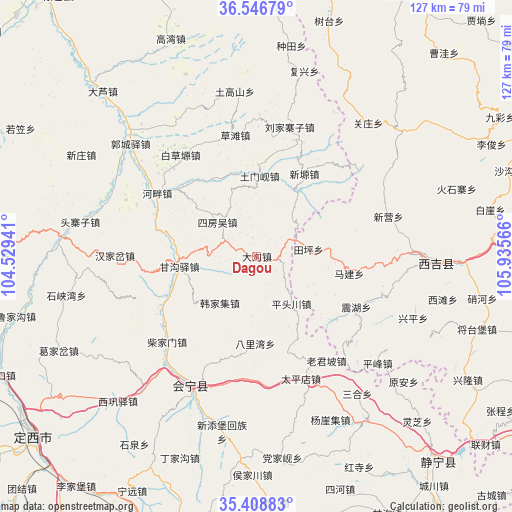
Dagou GPS coordinates[2]
35° 58' 47.496" North, 105° 13' 57.108" East
| Map corner | latitude | longitude |
|---|---|---|
| Upper-left | 36.54679°, | 104.52941° |
| Center: | 35.97986°, | 105.23253° |
| Lower-right: | 35.40883°, | 105.93566° |
| Map W x H: | 126.5×126.5 km | = 78.6×78.6mi |
| max Lat: | 53.31946° ⇑22.8% North |
| Dagou: | 35.97986° |
| min Lat: | ⇓77.2% South 18.22056° |
| min Long | Dagou | max Long |
| 75.07348° | 105.23253° | 134.28917° |
| W 11.3%⇐ | ⇒88.7% E |
Elevation
Elevation of Dagou is 1883 m = 6178 ft, and this is 1398.2 m = 4587 ft above average elevation for this country.
| Max E: |
5622 m = 18445 ft | 5.9% |
| Dagou | 1883 m 6178 ft | |
| Avg. | 484.8 m = 1591 ft | |
Min E: |
-3 m = -10 ft | 94.1% |
See also: China elevation on elevation.city.
Geographical zone
Dagou is located in North temperate zone (between Tropic of Cancer and the Arctic Circle). Distance of this Northern Tropic circle is 1394.7 km =866.6 mi to South.| Distance of | km | miles | from Dagou |
|---|---|---|---|
| North Pole | 6006.5 | 3732.3 | to North |
| Arctic Circle | 3400.6 | 2113 | to North |
| Tropic Cancer | 1394.7 | 866.6 | to South |
| Equator | 4000.6 | 2485.9 | to South |


Nearby cities:
15 places around Dagou: (largest is in red/bold)
• Dangjiaxian
50.4 km =31.3 mi,  172°
172°
• Gangouyi
19.4 km =12.1 mi,  262°
262°
• Gongyi
54.6 km =33.9 mi,  126°
126°
• Hanjiaji
14.7 km =9.1 mi,  218°
218°
• Houjiachuan
54.2 km =33.7 mi,  181°
181°
• Huishi
36.1 km =22.4 mi,  207°
207°
• Jieshipu
49.4 km =30.7 mi,  146°
146°
• Laojunpo
31 km =19.3 mi, 146°
• Pingfeng
39.8 km =24.7 mi, 131°
• Qingjiangyi
38.4 km =23.9 mi, 151°
• Wangmin
49.5 km =30.8 mi,  113°
113°
• Xingping
41.5 km =25.8 mi, 111°
• Xitan
47.1 km =29.3 mi,  103°
103°
• Yuan’an
47.6 km =29.6 mi, 130°
• Zhongchuan
55.4 km =34.4 mi,  194°
194°
Sources, notices
• [Note1] Compared only with cities in China existing in our database
• [Src1] Map data: © OpenStreetMap contributors (CC-BY-SA)
• [Src2] Other city data from geonames.org with taken over terms of usage.
• [Src3] Geographical zone / Annual Mean Temperature by Robert A. Rohde @ Wikipedia
