Zhongchuan geodata
Zhongchuan (Gansu) is a seat of a fourth-order administrative division; located in China in Asia/Shanghai (GMT+8) time zone. In our database, there are 1268 cities with bigger population. Compared to other cities in China, 76% of cities are located further ↓South; 88.9% of cities are located further →East and 94.1% of cities have lower elevation than Zhongchuan. Note1


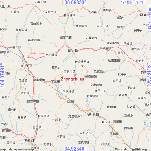
Zhongchuan GPS coordinates[2]
35° 29' 52.548" North, 105° 4' 40.908" East
| Map corner | latitude | longitude |
|---|---|---|
| Upper-left | 36.06833°, | 104.37491° |
| Center: | 35.49793°, | 105.07803° |
| Lower-right: | 34.92346°, | 105.78116° |
| Map W x H: | 127.3×127.3 km | = 79.1×79.1mi |
| max Lat: | 53.31946° ⇑24% North |
| Zhongchuan: | 35.49793° |
| min Lat: | ⇓76% South 18.22056° |
| min Long | Zhongchuan | max Long |
| 75.07348° | 105.07803° | 134.28917° |
| W 11.1%⇐ | ⇒88.9% E |
Elevation
Elevation of Zhongchuan is 1884 m = 6181 ft, and this is 1399.2 m = 4591 ft above average elevation for this country.
| Max E: |
5622 m = 18445 ft | 5.9% |
| Zhongchuan | 1884 m 6181 ft | |
| Avg. | 484.8 m = 1591 ft | |
Min E: |
-3 m = -10 ft | 94.1% |
See also: China elevation on elevation.city.
Geographical zone
Zhongchuan is located in North temperate zone (between Tropic of Cancer and the Arctic Circle). Distance of this Northern Tropic circle is 1341.1 km =833.3 mi to South.| Distance of | km | miles | from Zhongchuan |
|---|---|---|---|
| North Pole | 6060.1 | 3765.6 | to North |
| Arctic Circle | 3454.2 | 2146.3 | to North |
| Tropic Cancer | 1341.1 | 833.3 | to South |
| Equator | 3947 | 2452.6 | to South |


Nearby cities:
15 places around Zhongchuan: (largest is in red/bold)
• Dangjiaxian
20.6 km =12.8 mi,  80°
80°
• Dingxi
42 km =26.1 mi,  281°
281°
• Gangouyi
51.2 km =31.8 mi,  354°
354°
• Hanjiaji
42.4 km =26.3 mi,  6°
6°
• Houjiachuan
12.9 km =8 mi,  92°
92°
• Huajialing
14.6 km =9.1 mi,  205°
205°
• Huishi
21.7 km =13.5 mi, 352°
• Jieshipu
43.4 km =27 mi,  73°
73°
• Laojunpo
41.6 km =25.8 mi,  48°
48°
• Maying
22 km =13.7 mi,  193°
193°
• Pingfeng
51.5 km =32 mi,  58°
58°
• Pingxiang
35.8 km =22.2 mi,  154°
154°
• Qingjiangyi
38.3 km =23.8 mi, 58°
• Xindian
43 km =26.7 mi,  112°
112°
• Zhonghualu
45.1 km =28 mi,  285°
285°
Sources, notices
• [Note1] Compared only with cities in China existing in our database
• [Src1] Map data: © OpenStreetMap contributors (CC-BY-SA)
• [Src2] Other city data from geonames.org with taken over terms of usage.
• [Src3] Geographical zone / Annual Mean Temperature by Robert A. Rohde @ Wikipedia
