Zhiqing Songduo geodata
Zhiqing Songduo (Qinghai) is a seat of a third-order administrative division; located in China in Asia/Shanghai (GMT+8) time zone. In our database, there are 1268 cities with bigger population. Compared to other cities in China, 67.8% of cities are located further ↓South; 93.5% of cities are located further →East and 98.2% of cities have lower elevation than Zhiqing Songduo. Note1


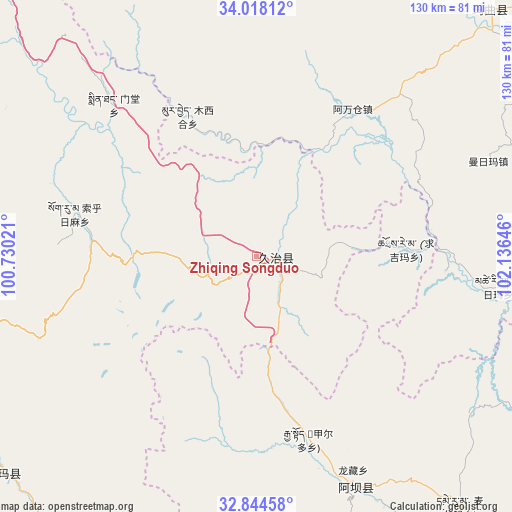
Zhiqing Songduo GPS coordinates[2]
33° 25' 59.988" North, 101° 25' 59.988" East
| Map corner | latitude | longitude |
|---|---|---|
| Upper-left | 34.01812°, | 100.73021° |
| Center: | 33.43333°, | 101.43333° |
| Lower-right: | 32.84458°, | 102.13646° |
| Map W x H: | 130.5×130.5 km | = 81.1×81.1mi |
| max Lat: | 53.31946° ⇑32.2% North |
| Zhiqing Songduo: | 33.43333° |
| min Lat: | ⇓67.8% South 18.22056° |
| min Long | Zhiqing Songduo | max Long |
| 75.07348° | 101.43333° | 134.28917° |
| W 6.5%⇐ | ⇒93.5% E |
Elevation
Elevation of Zhiqing Songduo is 3778 m = 12395 ft, and this is 3293.2 m = 10804 ft above average elevation for this country.
| Max E: |
5622 m = 18445 ft | 1.8% |
| Zhiqing Songduo | 3778 m 12395 ft | |
| Avg. | 484.8 m = 1591 ft | |
Min E: |
-3 m = -10 ft | 98.2% |
See also: China elevation on elevation.city.
Geographical zone
Zhiqing Songduo is located in North temperate zone (between Tropic of Cancer and the Arctic Circle). Distance of this Northern Tropic circle is 1111.5 km =690.7 mi to South.| Distance of | km | miles | from Zhiqing Songduo |
|---|---|---|---|
| North Pole | 6289.6 | 3908.2 | to North |
| Arctic Circle | 3683.7 | 2288.9 | to North |
| Tropic Cancer | 1111.5 | 690.7 | to South |
| Equator | 3717.4 | 2309.9 | to South |


Nearby cities:
15 places around Zhiqing Songduo: (largest is in red/bold)
• Aba
63.9 km =39.7 mi,  156°
156°
• Andou
49.2 km =30.6 mi,  167°
167°
• Awancang
44.8 km =27.8 mi,  33°
33°
• Dege
59.5 km =37 mi, 162°
• Gemo
50.7 km =31.5 mi, 161°
• Hezhi
61.2 km =38 mi, 161°
• Jia’erduo
48.5 km =30.1 mi, 164°
• Longcang
60.2 km =37.4 mi, 155°
• Maima
63.2 km =39.3 mi,  68°
68°
• Mintang
55.1 km =34.2 mi,  317°
317°
• Muxihe
40 km =24.9 mi,  334°
334°
• Qihama
51.6 km =32.1 mi,  96°
96°
• Qiujima
18.3 km =11.4 mi,  80°
80°
• Suohurima
47.8 km =29.7 mi,  282°
282°
• Wa’erma
62.6 km =38.9 mi,  154°
154°
Sources, notices
• [Note1] Compared only with cities in China existing in our database
• [Src1] Map data: © OpenStreetMap contributors (CC-BY-SA)
• [Src2] Other city data from geonames.org with taken over terms of usage.
• [Src3] Geographical zone / Annual Mean Temperature by Robert A. Rohde @ Wikipedia
