Chenjiatan geodata
Chenjiatan (Hunan) is a seat of a fourth-order administrative division; located in China in Asia/Shanghai (GMT+8) time zone. In our database, there are 1268 cities with bigger population. Compared to other cities in China, 68.1% of cities are located further ↑North; 68.1% of cities are located further →East and 52.4% of cities have higher elevation than Chenjiatan. Note1


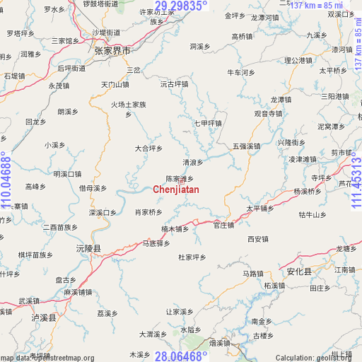
Chenjiatan GPS coordinates[2]
28° 40' 59.988" North, 110° 45' 0" East
| Map corner | latitude | longitude |
|---|---|---|
| Upper-left | 29.29835°, | 110.04688° |
| Center: | 28.68333°, | 110.75° |
| Lower-right: | 28.06468°, | 111.45313° |
| Map W x H: | 137.2×137.2 km | = 85.3×85.3mi |
| max Lat: | 53.31946° ⇑68.1% North |
| Chenjiatan: | 28.68333° |
| min Lat: | ⇓31.9% South 18.22056° |
| min Long | Chenjiatan | max Long |
| 75.07348° | 110.75° | 134.28917° |
| W 31.9%⇐ | ⇒68.1% E |
Elevation
Elevation of Chenjiatan is 147 m = 482 ft, and this is 337.8 m = 1108 ft below average elevation for this country.
| Max E: |
5622 m = 18445 ft | 52.4% |
| Avg. | 484.8 m = 1591 ft | |
| Chenjiatan | 147 m = 482 ft | |
Min E: |
-3 m = -10 ft | 47.6% |
See also: China elevation on elevation.city.
Geographical zone
Chenjiatan is located in North temperate zone (between Tropic of Cancer and the Arctic Circle). Distance of this Northern Tropic circle is 583.4 km =362.5 mi to South.| Distance of | km | miles | from Chenjiatan |
|---|---|---|---|
| North Pole | 6817.8 | 4236.4 | to North |
| Arctic Circle | 4211.9 | 2617.2 | to North |
| Tropic Cancer | 583.4 | 362.5 | to South |
| Equator | 3189.3 | 1981.7 | to South |


Nearby cities:
15 places around Chenjiatan: (largest is in red/bold)
• Cangchang
38.7 km =24 mi,  153°
153°
• Canmang
29.7 km =18.5 mi,  27°
27°
• Cha’anpu
40 km =24.9 mi,  97°
97°
• Guanzhuang
22.2 km =13.8 mi,  138°
138°
• Huangrangping
24.4 km =15.2 mi,  90°
90°
• Huochang
33.9 km =21.1 mi,  323°
323°
• Luoping
20.9 km =13 mi,  269°
269°
• Nanmu
26.9 km =16.7 mi,  35°
35°
• Qijiaping
24.6 km =15.3 mi,  24°
24°
• Qijiaxi
22.9 km =14.2 mi,  334°
334°
• Shuangxiqiao
39.6 km =24.6 mi,  344°
344°
• Wangjiaping
40.6 km =25.2 mi,  8°
8°
• Xiejiaya
34.3 km =21.3 mi,  346°
346°
• Xi’an
37.9 km =23.5 mi,  129°
129°
• Yuanguping
37.1 km =23.1 mi,  356°
356°
Sources, notices
• [Note1] Compared only with cities in China existing in our database
• [Src1] Map data: © OpenStreetMap contributors (CC-BY-SA)
• [Src2] Other city data from geonames.org with taken over terms of usage.
• [Src3] Geographical zone / Annual Mean Temperature by Robert A. Rohde @ Wikipedia
