Yangri geodata
Yangri (Hubei) is a seat of a fourth-order administrative division; located in China in Asia/Shanghai (GMT+8) time zone. In our database, there are 1268 cities with bigger population. Compared to other cities in China, 59.8% of cities are located further ↓South; 67.9% of cities are located further →East and 74.6% of cities have lower elevation than Yangri. Note1


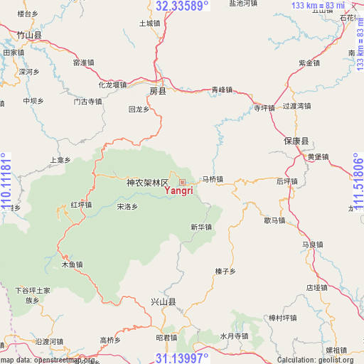
Yangri GPS coordinates[2]
31° 44' 23.496" North, 110° 48' 53.748" East
| Map corner | latitude | longitude |
|---|---|---|
| Upper-left | 32.33589°, | 110.11181° |
| Center: | 31.73986°, | 110.81493° |
| Lower-right: | 31.13997°, | 111.51806° |
| Map W x H: | 133×133 km | = 82.6×82.6mi |
| max Lat: | 53.31946° ⇑40.2% North |
| Yangri: | 31.73986° |
| min Lat: | ⇓59.8% South 18.22056° |
| min Long | Yangri | max Long |
| 75.07348° | 110.81493° | 134.28917° |
| W 32.1%⇐ | ⇒67.9% E |
Elevation
Elevation of Yangri is 513 m = 1683 ft, and this is 28.2 m = 93 ft above average elevation for this country.
| Max E: |
5622 m = 18445 ft | 25.4% |
| Yangri | 513 m 1683 ft | |
| Avg. | 484.8 m = 1591 ft | |
Min E: |
-3 m = -10 ft | 74.6% |
See also: China elevation on elevation.city.
Geographical zone
Yangri is located in North temperate zone (between Tropic of Cancer and the Arctic Circle). Distance of this Northern Tropic circle is 923.2 km =573.6 mi to South.| Distance of | km | miles | from Yangri |
|---|---|---|---|
| North Pole | 6477.9 | 4025.2 | to North |
| Arctic Circle | 3872 | 2405.9 | to North |
| Tropic Cancer | 923.2 | 573.6 | to South |
| Equator | 3529.1 | 2192.9 | to South |


Nearby cities:
15 places around Yangri: (largest is in red/bold)
• Baokang Chengguanzhen
44.5 km =27.7 mi,  69°
69°
• Fangxian Chengguanzhen
35.9 km =22.3 mi,  347°
347°
• Gufu
42.8 km =26.6 mi,  190°
190°
• Hongping
37.8 km =23.5 mi,  258°
258°
• Houping
38.5 km =23.9 mi,  89°
89°
• Hualongyan
44.1 km =27.4 mi,  324°
324°
• Jundian
39.9 km =24.8 mi,  332°
332°
• Maqiao
11.2 km =7 mi,  82°
82°
• Mengusi
45.6 km =28.3 mi,  310°
310°
• Nanyang
49.3 km =30.6 mi,  196°
196°
• Qingfeng
37 km =23 mi,  22°
22°
• Siping
40.6 km =25.2 mi,  47°
47°
• Songbai
13.6 km =8.5 mi,  277°
277°
• Xiema
36.4 km =22.6 mi,  111°
111°
• Zhenzi
35.6 km =22.1 mi,  154°
154°
Sources, notices
• [Note1] Compared only with cities in China existing in our database
• [Src1] Map data: © OpenStreetMap contributors (CC-BY-SA)
• [Src2] Other city data from geonames.org with taken over terms of usage.
• [Src3] Geographical zone / Annual Mean Temperature by Robert A. Rohde @ Wikipedia
