Bamencheng geodata
Bamencheng (Tianjin) is a populated place; located in China in Asia/Shanghai (GMT+8) time zone. With population of 3,167 people, there are 936 cities with bigger population in this country. Compared to other cities in China, 84.9% of cities are located further ↓South; 69.1% of cities are located further ←West and 95.9% of cities have higher elevation than Bamencheng. Note1


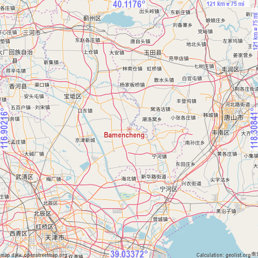
Bamencheng GPS coordinates[2]
39° 34' 40.008" North, 117° 36' 19.008" East
| Map corner | latitude | longitude |
|---|---|---|
| Upper-left | 40.1176°, | 116.90216° |
| Center: | 39.57778°, | 117.60528° |
| Lower-right: | 39.03372°, | 118.30841° |
| Map W x H: | 120.5×120.5 km | = 74.9×74.9mi |
| max Lat: | 53.31946° ⇑15.1% North |
| Bamencheng: | 39.57778° |
| min Lat: | ⇓84.9% South 18.22056° |
| min Long | Bamencheng | max Long |
| 75.07348° | 117.60528° | 134.28917° |
| W 69.1%⇐ | ⇒30.9% E |
Elevation
Elevation of Bamencheng is 6 m = 20 ft, and this is 478.8 m = 1571 ft below average elevation for this country.
| Max E: |
5622 m = 18445 ft | 95.9% |
| Avg. | 484.8 m = 1591 ft | |
| Bamencheng | 6 m = 20 ft | |
Min E: |
-3 m = -10 ft | 4.1% |
See also: China elevation on elevation.city.
Geographical zone
Bamencheng is located in North temperate zone (between Tropic of Cancer and the Arctic Circle). Distance of this Northern Tropic circle is 1794.7 km =1115.2 mi to South.| Distance of | km | miles | from Bamencheng |
|---|---|---|---|
| North Pole | 5606.4 | 3483.7 | to North |
| Arctic Circle | 3000.5 | 1864.4 | to North |
| Tropic Cancer | 1794.7 | 1115.2 | to South |
| Equator | 4400.6 | 2734.4 | to South |


Nearby cities:
15 places around Bamencheng: (largest is in red/bold)
• Beilizigu
15.4 km =9.6 mi,  231°
231°
• Dadengzhuang
10.2 km =6.3 mi,  174°
174°
• Daxinzhuang
10.8 km =6.7 mi,  139°
139°
• Dazhongzhuang
12 km =7.5 mi,  342°
342°
• Dongjituo
17.5 km =10.9 mi,  188°
188°
• Fengtai
12.5 km =7.8 mi,  100°
100°
• Gaojingzhuang
18.1 km =11.2 mi, 173°
• Heilangkou
17.9 km =11.1 mi,  282°
282°
• Huangzhuang
13.3 km =8.3 mi,  216°
216°
• Jiangwakou
10.4 km =6.5 mi,  126°
126°
• Lintingkou
10.7 km =6.6 mi,  302°
302°
• Nanmaizhu
14.6 km =9.1 mi,  124°
124°
• Ninghe
18.6 km =11.6 mi, 133°
• Wangbuzhuang
18.8 km =11.7 mi,  306°
306°
• Zhaobenzhuang
12.9 km =8 mi, 169°
Sources, notices
• [Note1] Compared only with cities in China existing in our database
• [Src1] Map data: © OpenStreetMap contributors (CC-BY-SA)
• [Src2] Other city data from geonames.org with taken over terms of usage.
• [Src3] Geographical zone / Annual Mean Temperature by Robert A. Rohde @ Wikipedia
