Baiyun geodata
Baiyun (Fujian) is a seat of a fourth-order administrative division; located in China in Asia/Shanghai (GMT+8) time zone. With population of 2,160 people, there are 1014 cities with bigger population in this country. Compared to other cities in China, 82.2% of cities are located further ↑North; 75.5% of cities are located further ←West and 74.9% of cities have lower elevation than Baiyun. Note1


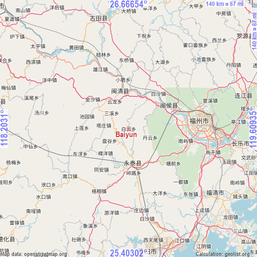
Baiyun GPS coordinates[2]
26° 2' 11.328" North, 118° 54' 22.392" East
| Map corner | latitude | longitude |
|---|---|---|
| Upper-left | 26.66654°, | 118.2031° |
| Center: | 26.03648°, | 118.90622° |
| Lower-right: | 25.40302°, | 119.60935° |
| Map W x H: | 140.5×140.5 km | = 87.3×87.3mi |
| max Lat: | 53.31946° ⇑82.2% North |
| Baiyun: | 26.03648° |
| min Lat: | ⇓17.8% South 18.22056° |
| min Long | Baiyun | max Long |
| 75.07348° | 118.90622° | 134.28917° |
| W 75.5%⇐ | ⇒24.5% E |
Elevation
Elevation of Baiyun is 519 m = 1703 ft, and this is 34.2 m = 112 ft above average elevation for this country.
| Max E: |
5622 m = 18445 ft | 25.1% |
| Baiyun | 519 m 1703 ft | |
| Avg. | 484.8 m = 1591 ft | |
Min E: |
-3 m = -10 ft | 74.9% |
See also: China elevation on elevation.city.
Geographical zone
Baiyun is located in North temperate zone (between Tropic of Cancer and the Arctic Circle). Distance of this Northern Tropic circle is 289.1 km =179.6 mi to South.| Distance of | km | miles | from Baiyun |
|---|---|---|---|
| North Pole | 7112.1 | 4419.3 | to North |
| Arctic Circle | 4506.2 | 2800 | to North |
| Tropic Cancer | 289.1 | 179.6 | to South |
| Equator | 2895 | 1798.9 | to South |


Nearby cities:
15 places around Baiyun: (largest is in red/bold)
• Baizhang
19 km =11.8 mi,  328°
328°
• Bandong
16.2 km =10.1 mi,  301°
301°
• Chengfeng
18.9 km =11.7 mi,  171°
171°
• Danyun
12.5 km =7.8 mi,  112°
112°
• Hongwei
17.3 km =10.7 mi,  31°
31°
• Hongxing
8.4 km =5.2 mi,  235°
235°
• Meipu
19.5 km =12.1 mi,  356°
356°
• Meixi
19.4 km =12.1 mi,  351°
351°
• Pangu
12.3 km =7.6 mi, 237°
• Qingliang
15.1 km =9.4 mi, 174°
• Sanxi
12.7 km =7.9 mi,  312°
312°
• Shenghuang
19 km =11.8 mi,  253°
253°
• Tazhuang
13.7 km =8.5 mi,  278°
278°
• Yunlong
16.8 km =10.4 mi, 332°
• Zhangyang
18.4 km =11.4 mi,  223°
223°
Sources, notices
• [Note1] Compared only with cities in China existing in our database
• [Src1] Map data: © OpenStreetMap contributors (CC-BY-SA)
• [Src2] Other city data from geonames.org with taken over terms of usage.
• [Src3] Geographical zone / Annual Mean Temperature by Robert A. Rohde @ Wikipedia
