Qingjiangqiao geodata
Qingjiangqiao (Hunan) is a populated place; located in China in Asia/Shanghai (GMT+8) time zone. With population of 1,090 people, there are 1158 cities with bigger population in this country. Compared to other cities in China, 80.1% of cities are located further ↑North; 67% of cities are located further →East and 64.9% of cities have lower elevation than Qingjiangqiao. Note1


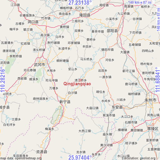
Qingjiangqiao GPS coordinates[2]
26° 36' 15.984" North, 110° 59' 7.008" East
| Map corner | latitude | longitude |
|---|---|---|
| Upper-left | 27.23138°, | 110.28216° |
| Center: | 26.60444°, | 110.98528° |
| Lower-right: | 25.97404°, | 111.68841° |
| Map W x H: | 139.8×139.8 km | = 86.9×86.9mi |
| max Lat: | 53.31946° ⇑80.1% North |
| Qingjiangqiao: | 26.60444° |
| min Lat: | ⇓19.9% South 18.22056° |
| min Long | Qingjiangqiao | max Long |
| 75.07348° | 110.98528° | 134.28917° |
| W 33%⇐ | ⇒67% E |
Elevation
Elevation of Qingjiangqiao is 323 m = 1060 ft, and this is 161.8 m = 531 ft below average elevation for this country.
| Max E: |
5622 m = 18445 ft | 35.1% |
| Avg. | 484.8 m = 1591 ft | |
| Qingjiangqiao | 323 m = 1060 ft | |
Min E: |
-3 m = -10 ft | 64.9% |
See also: China elevation on elevation.city.
Geographical zone
Qingjiangqiao is located in North temperate zone (between Tropic of Cancer and the Arctic Circle). Distance of this Northern Tropic circle is 352.2 km =218.8 mi to South.| Distance of | km | miles | from Qingjiangqiao |
|---|---|---|---|
| North Pole | 7048.9 | 4380 | to North |
| Arctic Circle | 4443 | 2760.8 | to North |
| Tropic Cancer | 352.2 | 218.8 | to South |
| Equator | 2958.1 | 1838.1 | to South |


Nearby cities:
15 places around Qingjiangqiao: (largest is in red/bold)
• Baisha
10.6 km =6.6 mi,  210°
210°
• Baiyashi
36.5 km =22.7 mi,  131°
131°
• Dengjiapu
34 km =21.1 mi,  349°
349°
• Dengyuantai
45 km =28 mi,  281°
281°
• Gaoqiao
9.1 km =5.7 mi,  290°
290°
• Huangjin Yaozuxiang
47.5 km =29.5 mi,  244°
244°
• Huanglong
8.6 km =5.3 mi,  215°
215°
• Huangqiao
48.6 km =30.2 mi,  342°
342°
• Jinshi
27.7 km =17.2 mi, 221°
• Langshan
30.1 km =18.7 mi, 214°
• Malin
38 km =23.6 mi, 244°
• Tangdukou
47.6 km =29.6 mi,  32°
32°
• Wantang
23.8 km =14.8 mi,  252°
252°
• Wantouqiao
44.9 km =27.9 mi,  305°
305°
• Yaoshi
39.7 km =24.7 mi, 209°
Sources, notices
• [Note1] Compared only with cities in China existing in our database
• [Src1] Map data: © OpenStreetMap contributors (CC-BY-SA)
• [Src2] Other city data from geonames.org with taken over terms of usage.
• [Src3] Geographical zone / Annual Mean Temperature by Robert A. Rohde @ Wikipedia
