Bacheng geodata
Bacheng (Jiangsu) is a seat of a fourth-order administrative division; located in China in Asia/Shanghai (GMT+8) time zone. In our database, there are 1268 cities with bigger population. Compared to other cities in China, 58.1% of cities are located further ↓South; 87.2% of cities are located further ←West and 97.2% of cities have higher elevation than Bacheng. Note1


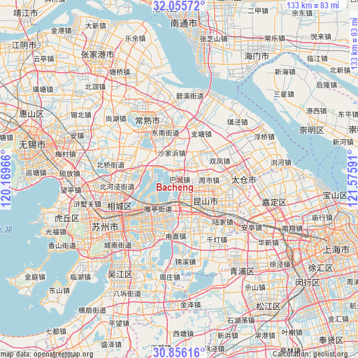
Bacheng GPS coordinates[2]
31° 27' 28.296" North, 120° 52' 22.008" East
| Map corner | latitude | longitude |
|---|---|---|
| Upper-left | 32.05572°, | 120.16966° |
| Center: | 31.45786°, | 120.87278° |
| Lower-right: | 30.85616°, | 121.57591° |
| Map W x H: | 133.4×133.4 km | = 82.9×82.9mi |
| max Lat: | 53.31946° ⇑41.9% North |
| Bacheng: | 31.45786° |
| min Lat: | ⇓58.1% South 18.22056° |
| min Long | Bacheng | max Long |
| 75.07348° | 120.87278° | 134.28917° |
| W 87.2%⇐ | ⇒12.8% E |
Elevation
Elevation of Bacheng is 5 m = 16 ft, and this is 479.8 m = 1574 ft below average elevation for this country.
| Max E: |
5622 m = 18445 ft | 97.2% |
| Avg. | 484.8 m = 1591 ft | |
| Bacheng | 5 m = 16 ft | |
Min E: |
-3 m = -10 ft | 2.8% |
See also: China elevation on elevation.city.
Geographical zone
Bacheng is located in North temperate zone (between Tropic of Cancer and the Arctic Circle). Distance of this Northern Tropic circle is 891.9 km =554.2 mi to South.| Distance of | km | miles | from Bacheng |
|---|---|---|---|
| North Pole | 6509.3 | 4044.7 | to North |
| Arctic Circle | 3903.4 | 2425.5 | to North |
| Tropic Cancer | 891.9 | 554.2 | to South |
| Equator | 3497.8 | 2173.4 | to South |


Nearby cities:
15 places around Bacheng: (largest is in red/bold)
• Chengxiang
21 km =13 mi,  93°
93°
• Guli
19.7 km =12.2 mi,  349°
349°
• Kunshan
11.8 km =7.3 mi,  139°
139°
• Luzhi
20.2 km =12.6 mi,  181°
181°
• Shajiabang
10.4 km =6.5 mi, 346°
• Shaxi
21.2 km =13.2 mi,  55°
55°
• Shengpu
17.8 km =11.1 mi,  197°
197°
• Shuangfeng
15.9 km =9.9 mi,  65°
65°
• Taiping
16.8 km =10.4 mi,  261°
261°
• Weiting
21 km =13 mi,  233°
233°
• Xinzhuang
19.6 km =12.2 mi,  296°
296°
• Yangdenghu
14.7 km =9.1 mi,  285°
285°
• Zhangpu
20.3 km =12.6 mi,  159°
159°
• Zhitang
18.7 km =11.6 mi,  24°
24°
• Zhoushi
11.2 km =7 mi, 85°
Sources, notices
• [Note1] Compared only with cities in China existing in our database
• [Src1] Map data: © OpenStreetMap contributors (CC-BY-SA)
• [Src2] Other city data from geonames.org with taken over terms of usage.
• [Src3] Geographical zone / Annual Mean Temperature by Robert A. Rohde @ Wikipedia
