Zhangpu geodata
Zhangpu (Jiangsu) is a seat of a fourth-order administrative division; located in China in Asia/Shanghai (GMT+8) time zone. In our database, there are 1268 cities with bigger population. Compared to other cities in China, 56.9% of cities are located further ↓South; 87.6% of cities are located further ←West and 97.2% of cities have higher elevation than Zhangpu. Note1


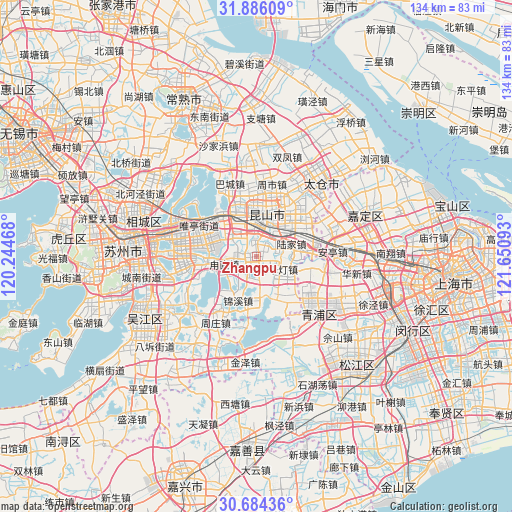
Zhangpu GPS coordinates[2]
31° 17' 13.704" North, 120° 56' 52.08" East
| Map corner | latitude | longitude |
|---|---|---|
| Upper-left | 31.88609°, | 120.24468° |
| Center: | 31.28714°, | 120.9478° |
| Lower-right: | 30.68436°, | 121.65093° |
| Map W x H: | 133.6×133.6 km | = 83×83mi |
| max Lat: | 53.31946° ⇑43.1% North |
| Zhangpu: | 31.28714° |
| min Lat: | ⇓56.9% South 18.22056° |
| min Long | Zhangpu | max Long |
| 75.07348° | 120.9478° | 134.28917° |
| W 87.6%⇐ | ⇒12.4% E |
Elevation
Elevation of Zhangpu is 5 m = 16 ft, and this is 479.8 m = 1574 ft below average elevation for this country.
| Max E: |
5622 m = 18445 ft | 97.2% |
| Avg. | 484.8 m = 1591 ft | |
| Zhangpu | 5 m = 16 ft | |
Min E: |
-3 m = -10 ft | 2.8% |
See also: China elevation on elevation.city.
Geographical zone
Zhangpu is located in North temperate zone (between Tropic of Cancer and the Arctic Circle). Distance of this Northern Tropic circle is 872.9 km =542.4 mi to South.| Distance of | km | miles | from Zhangpu |
|---|---|---|---|
| North Pole | 6528.3 | 4056.5 | to North |
| Arctic Circle | 3922.4 | 2437.3 | to North |
| Tropic Cancer | 872.9 | 542.4 | to South |
| Equator | 3478.8 | 2161.6 | to South |


Nearby cities:
15 places around Zhangpu: (largest is in red/bold)
• Anting
20 km =12.4 mi,  86°
86°
• Bacheng
20.3 km =12.6 mi,  339°
339°
• Baihe
18.3 km =11.4 mi,  100°
100°
• Dianshanhu
13.6 km =8.5 mi,  147°
147°
• Huaqiao
13.1 km =8.1 mi,  82°
82°
• Jinxi
13.1 km =8.1 mi,  203°
203°
• Kunshan
10.1 km =6.3 mi,  3°
3°
• Lujia
9.6 km =6 mi,  70°
70°
• Luzhi
7.7 km =4.8 mi,  261°
261°
• Qiandeng
5.2 km =3.2 mi,  115°
115°
• Shengpu
12.6 km =7.8 mi,  279°
279°
• Xianghuaqiao
20.4 km =12.7 mi,  127°
127°
• Yingpu
21 km =13 mi, 134°
• Zhoushi
20.2 km =12.6 mi,  11°
11°
• Zhouzhuang
21.2 km =13.2 mi,  207°
207°
Sources, notices
• [Note1] Compared only with cities in China existing in our database
• [Src1] Map data: © OpenStreetMap contributors (CC-BY-SA)
• [Src2] Other city data from geonames.org with taken over terms of usage.
• [Src3] Geographical zone / Annual Mean Temperature by Robert A. Rohde @ Wikipedia
