Xinzhuang geodata
Xinzhuang (Jiangsu) is a seat of a fourth-order administrative division; located in China in Asia/Shanghai (GMT+8) time zone. In our database, there are 1268 cities with bigger population. Compared to other cities in China, 58.6% of cities are located further ↓South; 86.2% of cities are located further ←West and 99.4% of cities have higher elevation than Xinzhuang. Note1


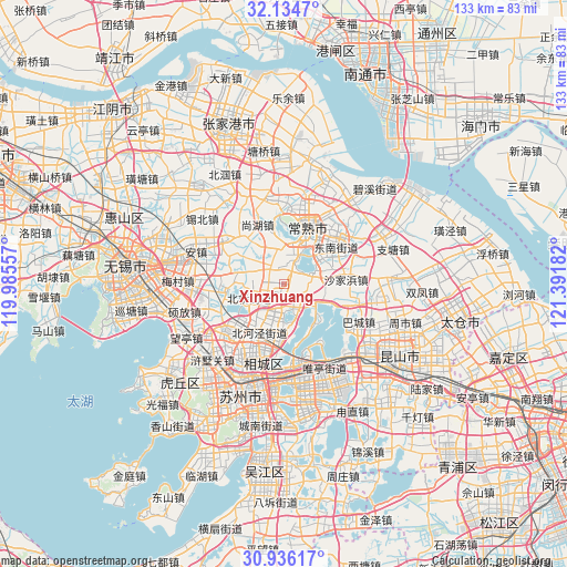
Xinzhuang GPS coordinates[2]
31° 32' 14.496" North, 120° 41' 19.284" East
| Map corner | latitude | longitude |
|---|---|---|
| Upper-left | 32.1347°, | 119.98557° |
| Center: | 31.53736°, | 120.68869° |
| Lower-right: | 30.93617°, | 121.39182° |
| Map W x H: | 133.3×133.3 km | = 82.8×82.8mi |
| max Lat: | 53.31946° ⇑41.4% North |
| Xinzhuang: | 31.53736° |
| min Lat: | ⇓58.6% South 18.22056° |
| min Long | Xinzhuang | max Long |
| 75.07348° | 120.68869° | 134.28917° |
| W 86.2%⇐ | ⇒13.8% E |
Elevation
Elevation of Xinzhuang is 2 m = 7 ft, and this is 482.8 m = 1584 ft below average elevation for this country.
| Max E: |
5622 m = 18445 ft | 99.4% |
| Avg. | 484.8 m = 1591 ft | |
| Xinzhuang | 2 m = 7 ft | |
Min E: |
-3 m = -10 ft | 0.6% |
See also: China elevation on elevation.city.
Geographical zone
Xinzhuang is located in North temperate zone (between Tropic of Cancer and the Arctic Circle). Distance of this Northern Tropic circle is 900.7 km =559.7 mi to South.| Distance of | km | miles | from Xinzhuang |
|---|---|---|---|
| North Pole | 6500.4 | 4039.2 | to North |
| Arctic Circle | 3894.5 | 2419.9 | to North |
| Tropic Cancer | 900.7 | 559.7 | to South |
| Equator | 3506.6 | 2178.9 | to South |


Nearby cities:
15 places around Xinzhuang: (largest is in red/bold)
• Bacheng
19.6 km =12.2 mi,  116°
116°
• Beiqiao
9.4 km =5.8 mi,  250°
250°
• Changshu City
13.1 km =8.1 mi,  22°
22°
• Ehu
13.9 km =8.6 mi,  264°
264°
• Guli
17.4 km =10.8 mi,  52°
52°
• Hongshan
19.5 km =12.1 mi, 252°
• Huangdai
16.9 km =10.5 mi,  228°
228°
• Shajiabang
15.1 km =9.4 mi,  85°
85°
• Shanghu
15.7 km =9.8 mi,  338°
338°
• Taiping
11.4 km =7.1 mi,  175°
175°
• Weitang
9.1 km =5.7 mi,  207°
207°
• Yangdenghu
5.9 km =3.7 mi,  145°
145°
• Yangjian
16.3 km =10.1 mi,  308°
308°
• Yuanhe
16.9 km =10.5 mi,  204°
204°
• Yushan
18.9 km =11.7 mi,  34°
34°
Sources, notices
• [Note1] Compared only with cities in China existing in our database
• [Src1] Map data: © OpenStreetMap contributors (CC-BY-SA)
• [Src2] Other city data from geonames.org with taken over terms of usage.
• [Src3] Geographical zone / Annual Mean Temperature by Robert A. Rohde @ Wikipedia
