Shuitai geodata
Shuitai (Guangdong) is a seat of a fourth-order administrative division; located in China in Asia/Shanghai (GMT+8) time zone. In our database, there are 1268 cities with bigger population. Compared to other cities in China, 95.9% of cities are located further ↑North; 60.2% of cities are located further →East and 68% of cities have higher elevation than Shuitai. Note1


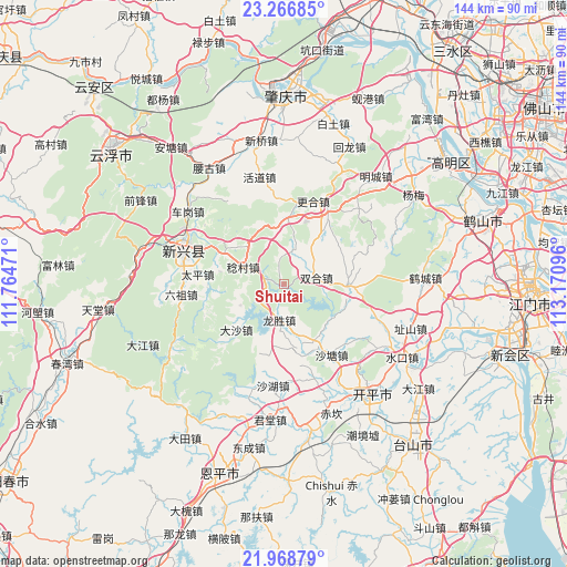
Shuitai GPS coordinates[2]
22° 37' 9.66" North, 112° 28' 4.188" East
| Map corner | latitude | longitude |
|---|---|---|
| Upper-left | 23.26685°, | 111.76471° |
| Center: | 22.61935°, | 112.46783° |
| Lower-right: | 21.96879°, | 113.17096° |
| Map W x H: | 144.3×144.3 km | = 89.7×89.7mi |
| max Lat: | 53.31946° ⇑95.9% North |
| Shuitai: | 22.61935° |
| min Lat: | ⇓4.1% South 18.22056° |
| min Long | Shuitai | max Long |
| 75.07348° | 112.46783° | 134.28917° |
| W 39.8%⇐ | ⇒60.2% E |
Elevation
Elevation of Shuitai is 60 m = 197 ft, and this is 424.8 m = 1394 ft below average elevation for this country.
| Max E: |
5622 m = 18445 ft | 68% |
| Avg. | 484.8 m = 1591 ft | |
| Shuitai | 60 m = 197 ft | |
Min E: |
-3 m = -10 ft | 32% |
See also: China elevation on elevation.city.
Geographical zone
Shuitai is located in North Torrid zone (between Equator and Tropic of Cancer). Distance of this Northern Tropic circle is 90.9 km =56.5 mi to North.| Distance of | km | miles | from Shuitai |
|---|---|---|---|
| North Pole | 7492 | 4655.3 | to North |
| Arctic Circle | 4886.1 | 3036.1 | to North |
| Tropic Cancer | 90.9 | 56.5 | to North |
| Equator | 2515 | 1562.7 | to South |


Nearby cities:
15 places around Shuitai: (largest is in red/bold)
• Cangcheng
17.7 km =11 mi,  152°
152°
• Dasha
16.8 km =10.4 mi,  228°
228°
• Dongcheng
17 km =10.6 mi,  295°
295°
• Genghe
21.5 km =13.4 mi,  31°
31°
• Huodao
28 km =17.4 mi,  347°
347°
• Liuzu
26.2 km =16.3 mi,  264°
264°
• Longsheng
8.4 km =5.2 mi,  185°
185°
• Magang
16 km =9.9 mi,  170°
170°
• Niujiang
28.5 km =17.7 mi,  198°
198°
• Rencun
11.3 km =7 mi,  293°
293°
• Shahu
25.7 km =16 mi, 186°
• Shatang
21.7 km =13.5 mi, 145°
• Taiping
23.8 km =14.8 mi,  275°
275°
• Xincheng
26.6 km =16.5 mi, 290°
• Zhaiwu
16.5 km =10.3 mi,  90°
90°
Sources, notices
• [Note1] Compared only with cities in China existing in our database
• [Src1] Map data: © OpenStreetMap contributors (CC-BY-SA)
• [Src2] Other city data from geonames.org with taken over terms of usage.
• [Src3] Geographical zone / Annual Mean Temperature by Robert A. Rohde @ Wikipedia
