Dagang geodata
Dagang (Guangdong) is a seat of a fourth-order administrative division; located in China in Asia/Shanghai (GMT+8) time zone. In our database, there are 1268 cities with bigger population. Compared to other cities in China, 90.8% of cities are located further ↑North; 62.6% of cities are located further →East and 66.4% of cities have higher elevation than Dagang. Note1


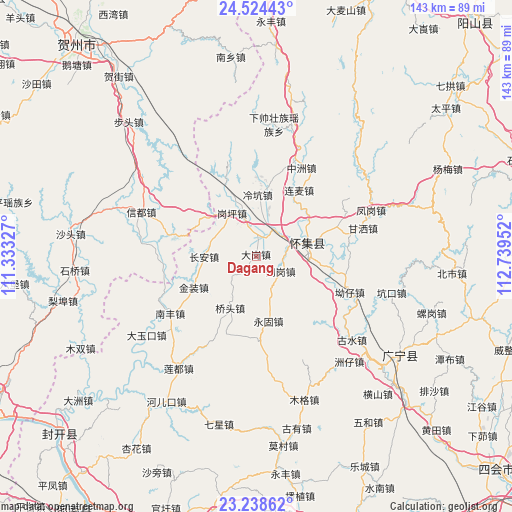
Dagang GPS coordinates[2]
23° 52' 59.232" North, 112° 2' 11.004" East
| Map corner | latitude | longitude |
|---|---|---|
| Upper-left | 24.52443°, | 111.33327° |
| Center: | 23.88312°, | 112.03639° |
| Lower-right: | 23.23862°, | 112.73952° |
| Map W x H: | 143×143 km | = 88.9×88.9mi |
| max Lat: | 53.31946° ⇑90.8% North |
| Dagang: | 23.88312° |
| min Lat: | ⇓9.2% South 18.22056° |
| min Long | Dagang | max Long |
| 75.07348° | 112.03639° | 134.28917° |
| W 37.4%⇐ | ⇒62.6% E |
Elevation
Elevation of Dagang is 67 m = 220 ft, and this is 417.8 m = 1371 ft below average elevation for this country.
| Max E: |
5622 m = 18445 ft | 66.4% |
| Avg. | 484.8 m = 1591 ft | |
| Dagang | 67 m = 220 ft | |
Min E: |
-3 m = -10 ft | 33.6% |
See also: China elevation on elevation.city.
Geographical zone
Dagang is located in North temperate zone (between Tropic of Cancer and the Arctic Circle). Distance of this Northern Tropic circle is 49.6 km =30.8 mi to South.| Distance of | km | miles | from Dagang |
|---|---|---|---|
| North Pole | 7351.5 | 4568 | to North |
| Arctic Circle | 4745.6 | 2948.8 | to North |
| Tropic Cancer | 49.6 | 30.8 | to South |
| Equator | 2655.6 | 1650.1 | to South |


Nearby cities:
15 places around Dagang: (largest is in red/bold)
• Aozai
29.1 km =18.1 mi,  110°
110°
• Chang’an
14.5 km =9 mi,  269°
269°
• Ganping
13.5 km =8.4 mi,  329°
329°
• Huaicheng
14.8 km =9.2 mi,  74°
74°
• Jinzhuang
19.6 km =12.2 mi,  242°
242°
• Lanzhong
22.2 km =13.8 mi,  336°
336°
• Lengkeng
16.8 km =10.4 mi,  0°
0°
• Liangcun
7.8 km =4.8 mi, 343°
• Lianmai
22 km =13.7 mi,  33°
33°
• Maning
17.9 km =11.1 mi, 335°
• Qiaotou
16.8 km =10.4 mi,  203°
203°
• Wenlang
27.3 km =17 mi, 65°
• Yonggu
18.9 km =11.7 mi,  169°
169°
• Zhagang
8.6 km =5.3 mi,  130°
130°
• Zhongzhou
27.7 km =17.2 mi, 27°
Sources, notices
• [Note1] Compared only with cities in China existing in our database
• [Src1] Map data: © OpenStreetMap contributors (CC-BY-SA)
• [Src2] Other city data from geonames.org with taken over terms of usage.
• [Src3] Geographical zone / Annual Mean Temperature by Robert A. Rohde @ Wikipedia
