Yonggu geodata
Yonggu (Guangdong) is a seat of a fourth-order administrative division; located in China in Asia/Shanghai (GMT+8) time zone. In our database, there are 1268 cities with bigger population. Compared to other cities in China, 91.3% of cities are located further ↑North; 62.4% of cities are located further →East and 60.1% of cities have higher elevation than Yonggu. Note1


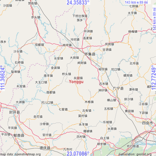
Yonggu GPS coordinates[2]
23° 42' 58.248" North, 112° 4' 9.696" East
| Map corner | latitude | longitude |
|---|---|---|
| Upper-left | 24.35833°, | 111.36624° |
| Center: | 23.71618°, | 112.06936° |
| Lower-right: | 23.07086°, | 112.77249° |
| Map W x H: | 143.2×143.2 km | = 89×89mi |
| max Lat: | 53.31946° ⇑91.3% North |
| Yonggu: | 23.71618° |
| min Lat: | ⇓8.7% South 18.22056° |
| min Long | Yonggu | max Long |
| 75.07348° | 112.06936° | 134.28917° |
| W 37.6%⇐ | ⇒62.4% E |
Elevation
Elevation of Yonggu is 98 m = 322 ft, and this is 386.8 m = 1269 ft below average elevation for this country.
| Max E: |
5622 m = 18445 ft | 60.1% |
| Avg. | 484.8 m = 1591 ft | |
| Yonggu | 98 m = 322 ft | |
Min E: |
-3 m = -10 ft | 39.9% |
See also: China elevation on elevation.city.
Geographical zone
Yonggu is located in North temperate zone (between Tropic of Cancer and the Arctic Circle). Distance of this Northern Tropic circle is 31.1 km =19.3 mi to South.| Distance of | km | miles | from Yonggu |
|---|---|---|---|
| North Pole | 7370.1 | 4579.6 | to North |
| Arctic Circle | 4764.2 | 2960.3 | to North |
| Tropic Cancer | 31.1 | 19.3 | to South |
| Equator | 2637 | 1638.6 | to South |


Nearby cities:
15 places around Yonggu: (largest is in red/bold)
• Aozai
25.4 km =15.8 mi,  70°
70°
• Chang’an
25.7 km =16 mi,  315°
315°
• Dagang
18.9 km =11.7 mi,  349°
349°
• Gushui
23.8 km =14.8 mi,  97°
97°
• Huaicheng
25.1 km =15.6 mi,  25°
25°
• Jinzhuang
22.8 km =14.2 mi,  294°
294°
• Liandu
29 km =18 mi,  240°
240°
• Liangcun
26.6 km =16.5 mi, 347°
• Muge
24.4 km =15.2 mi,  154°
154°
• Nanfeng
27.7 km =17.2 mi,  272°
272°
• Qiaotou
10.6 km =6.6 mi, 287°
• Shidong
10.6 km =6.6 mi,  181°
181°
• Shizui
14.2 km =8.8 mi,  140°
140°
• Zhagang
13.3 km =8.3 mi,  13°
13°
• Zhouzai
24.5 km =15.2 mi,  115°
115°
Sources, notices
• [Note1] Compared only with cities in China existing in our database
• [Src1] Map data: © OpenStreetMap contributors (CC-BY-SA)
• [Src2] Other city data from geonames.org with taken over terms of usage.
• [Src3] Geographical zone / Annual Mean Temperature by Robert A. Rohde @ Wikipedia
