Shangyuan geodata
Shangyuan (Zhejiang) is a seat of a fourth-order administrative division; located in China in Asia/Shanghai (GMT+8) time zone. In our database, there are 1268 cities with bigger population. Compared to other cities in China, 64.9% of cities are located further ↑North; 74.2% of cities are located further ←West and 52.7% of cities have higher elevation than Shangyuan. Note1


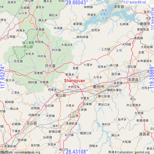
Shangyuan GPS coordinates[2]
29° 2' 51.324" North, 118° 39' 21.096" East
| Map corner | latitude | longitude |
|---|---|---|
| Upper-left | 29.66043°, | 117.95274° |
| Center: | 29.04759°, | 118.65586° |
| Lower-right: | 28.43108°, | 119.35899° |
| Map W x H: | 136.7×136.7 km | = 84.9×84.9mi |
| max Lat: | 53.31946° ⇑64.9% North |
| Shangyuan: | 29.04759° |
| min Lat: | ⇓35.1% South 18.22056° |
| min Long | Shangyuan | max Long |
| 75.07348° | 118.65586° | 134.28917° |
| W 74.2%⇐ | ⇒25.8% E |
Elevation
Elevation of Shangyuan is 145 m = 476 ft, and this is 339.8 m = 1115 ft below average elevation for this country.
| Max E: |
5622 m = 18445 ft | 52.7% |
| Avg. | 484.8 m = 1591 ft | |
| Shangyuan | 145 m = 476 ft | |
Min E: |
-3 m = -10 ft | 47.3% |
See also: China elevation on elevation.city.
Geographical zone
Shangyuan is located in North temperate zone (between Tropic of Cancer and the Arctic Circle). Distance of this Northern Tropic circle is 623.9 km =387.7 mi to South.| Distance of | km | miles | from Shangyuan |
|---|---|---|---|
| North Pole | 6777.3 | 4211.2 | to North |
| Arctic Circle | 4171.4 | 2592 | to North |
| Tropic Cancer | 623.9 | 387.7 | to South |
| Equator | 3229.8 | 2006.9 | to South |


Nearby cities:
15 places around Shangyuan: (largest is in red/bold)
• Baima
22.5 km =14 mi,  15°
15°
• Baitashan
20.1 km =12.5 mi,  99°
99°
• Datou
15.3 km =9.5 mi,  40°
40°
• Donglu
12.1 km =7.5 mi,  257°
257°
• Dongshandi
8.6 km =5.3 mi,  355°
355°
• Dong’an
7.2 km =4.5 mi,  178°
178°
• Fangcun
4.2 km =2.6 mi,  281°
281°
• Furong
8.5 km =5.3 mi,  347°
347°
• Hangbu
17 km =10.6 mi,  136°
136°
• Jiuhua
18.2 km =11.3 mi,  90°
90°
• Quzhou
22.9 km =14.2 mi,  115°
115°
• Shangsongfan
14 km =8.7 mi,  244°
244°
• Shiliang
12.7 km =7.9 mi, 103°
• Xikou
18.9 km =11.7 mi,  305°
305°
• Xinchang
7 km =4.3 mi,  295°
295°
Sources, notices
• [Note1] Compared only with cities in China existing in our database
• [Src1] Map data: © OpenStreetMap contributors (CC-BY-SA)
• [Src2] Other city data from geonames.org with taken over terms of usage.
• [Src3] Geographical zone / Annual Mean Temperature by Robert A. Rohde @ Wikipedia
