Qingyun geodata
Qingyun (Guangdong) is a seat of a fourth-order administrative division; located in China in Asia/Shanghai (GMT+8) time zone. In our database, there are 1268 cities with bigger population. Compared to other cities in China, 84.7% of cities are located further ↑North; 56.5% of cities are located further →East and 65.7% of cities have lower elevation than Qingyun. Note1


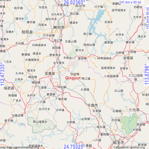
Qingyun GPS coordinates[2]
25° 23' 24.432" North, 113° 10' 35.292" East
| Map corner | latitude | longitude |
|---|---|---|
| Upper-left | 26.02365°, | 112.47335° |
| Center: | 25.39012°, | 113.17647° |
| Lower-right: | 24.75325°, | 113.8796° |
| Map W x H: | 141.3×141.3 km | = 87.8×87.8mi |
| max Lat: | 53.31946° ⇑84.7% North |
| Qingyun: | 25.39012° |
| min Lat: | ⇓15.3% South 18.22056° |
| min Long | Qingyun | max Long |
| 75.07348° | 113.17647° | 134.28917° |
| W 43.5%⇐ | ⇒56.5% E |
Elevation
Elevation of Qingyun is 338 m = 1109 ft, and this is 146.8 m = 482 ft below average elevation for this country.
| Max E: |
5622 m = 18445 ft | 34.3% |
| Avg. | 484.8 m = 1591 ft | |
| Qingyun | 338 m = 1109 ft | |
Min E: |
-3 m = -10 ft | 65.7% |
See also: China elevation on elevation.city.
Geographical zone
Qingyun is located in North temperate zone (between Tropic of Cancer and the Arctic Circle). Distance of this Northern Tropic circle is 217.2 km =135 mi to South.| Distance of | km | miles | from Qingyun |
|---|---|---|---|
| North Pole | 7183.9 | 4463.9 | to North |
| Arctic Circle | 4578.1 | 2844.7 | to North |
| Tropic Cancer | 217.2 | 135 | to South |
| Equator | 2823.1 | 1754.2 | to South |


Nearby cities:
15 places around Qingyun: (largest is in red/bold)
• Baishi
10.2 km =6.3 mi,  48°
48°
• Beixiang
28.5 km =17.7 mi,  139°
139°
• Dayuan
17 km =10.6 mi, 139°
• Huangpu
4.7 km =2.9 mi,  356°
356°
• Jiufeng
19.6 km =12.2 mi,  103°
103°
• Lecheng
34 km =21.1 mi,  149°
149°
• Liangjiang
12.6 km =7.8 mi, 99°
• Meihua
25.9 km =16.1 mi,  203°
203°
• Pingshi
16.6 km =10.3 mi,  225°
225°
• Sanxi
30.6 km =19 mi,  245°
245°
• Shaping
36.6 km =22.7 mi, 202°
• Wushan
34.2 km =21.3 mi,  116°
116°
• Xiushui
30.4 km =18.9 mi,  216°
216°
• Yizhang Chengguanzhen
19.9 km =12.4 mi,  267°
267°
• Yunyan
29.7 km =18.5 mi,  194°
194°
Sources, notices
• [Note1] Compared only with cities in China existing in our database
• [Src1] Map data: © OpenStreetMap contributors (CC-BY-SA)
• [Src2] Other city data from geonames.org with taken over terms of usage.
• [Src3] Geographical zone / Annual Mean Temperature by Robert A. Rohde @ Wikipedia
