Wushan geodata
Wushan (Guangdong) is a seat of a fourth-order administrative division; located in China in Asia/Shanghai (GMT+8) time zone. In our database, there are 1268 cities with bigger population. Compared to other cities in China, 85.3% of cities are located further ↑North; 54.4% of cities are located further →East and 66.7% of cities have lower elevation than Wushan. Note1


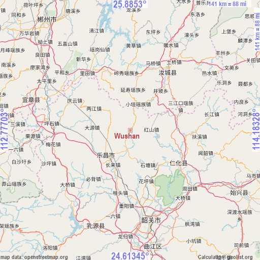
Wushan GPS coordinates[2]
25° 15' 3.744" North, 113° 28' 48.54" East
| Map corner | latitude | longitude |
|---|---|---|
| Upper-left | 25.8853°, | 112.77703° |
| Center: | 25.25104°, | 113.48015° |
| Lower-right: | 24.61345°, | 114.18328° |
| Map W x H: | 141.4×141.4 km | = 87.9×87.9mi |
| max Lat: | 53.31946° ⇑85.3% North |
| Wushan: | 25.25104° |
| min Lat: | ⇓14.7% South 18.22056° |
| min Long | Wushan | max Long |
| 75.07348° | 113.48015° | 134.28917° |
| W 45.6%⇐ | ⇒54.4% E |
Elevation
Elevation of Wushan is 355 m = 1165 ft, and this is 129.8 m = 426 ft below average elevation for this country.
| Max E: |
5622 m = 18445 ft | 33.3% |
| Avg. | 484.8 m = 1591 ft | |
| Wushan | 355 m = 1165 ft | |
Min E: |
-3 m = -10 ft | 66.7% |
See also: China elevation on elevation.city.
Geographical zone
Wushan is located in North temperate zone (between Tropic of Cancer and the Arctic Circle). Distance of this Northern Tropic circle is 201.7 km =125.3 mi to South.| Distance of | km | miles | from Wushan |
|---|---|---|---|
| North Pole | 7199.4 | 4473.5 | to North |
| Arctic Circle | 4593.5 | 2854.3 | to North |
| Tropic Cancer | 201.7 | 125.3 | to South |
| Equator | 2807.7 | 1744.6 | to South |


Nearby cities:
15 places around Wushan: (largest is in red/bold)
• Baishi
31.9 km =19.8 mi,  314°
314°
• Beixiang
13.7 km =8.5 mi,  242°
242°
• Bibei
33.6 km =20.9 mi,  216°
216°
• Changlai
20.3 km =12.6 mi,  205°
205°
• Chengkou
27.2 km =16.9 mi,  73°
73°
• Dayuan
19.6 km =12.2 mi,  277°
277°
• Dongtang
24.2 km =15 mi,  141°
141°
• Hongshan
11.3 km =7 mi,  87°
87°
• Huaping
28.1 km =17.5 mi,  160°
160°
• Jiufeng
15.8 km =9.8 mi, 313°
• Langtian
11 km =6.8 mi,  194°
194°
• Lecheng
18.9 km =11.7 mi, 223°
• Liangjiang
22.6 km =14 mi, 306°
• Renhua
32 km =19.9 mi,  123°
123°
• Shitang
21.5 km =13.4 mi, 155°
Sources, notices
• [Note1] Compared only with cities in China existing in our database
• [Src1] Map data: © OpenStreetMap contributors (CC-BY-SA)
• [Src2] Other city data from geonames.org with taken over terms of usage.
• [Src3] Geographical zone / Annual Mean Temperature by Robert A. Rohde @ Wikipedia
