Wuyahe geodata
Wuyahe (Hunan) is a seat of a fourth-order administrative division; located in China in Asia/Shanghai (GMT+8) time zone. In our database, there are 1268 cities with bigger population. Compared to other cities in China, 58.9% of cities are located further ↑North; 72.7% of cities are located further →East and 83.9% of cities have lower elevation than Wuyahe. Note1


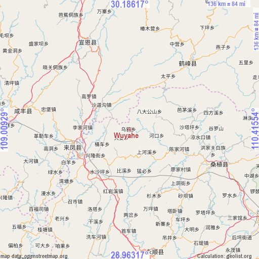
Wuyahe GPS coordinates[2]
29° 34' 35.472" North, 109° 42' 44.676" East
| Map corner | latitude | longitude |
|---|---|---|
| Upper-left | 30.18617°, | 109.00929° |
| Center: | 29.57652°, | 109.71241° |
| Lower-right: | 28.96317°, | 110.41554° |
| Map W x H: | 136×136 km | = 84.5×84.5mi |
| max Lat: | 53.31946° ⇑58.9% North |
| Wuyahe: | 29.57652° |
| min Lat: | ⇓41.1% South 18.22056° |
| min Long | Wuyahe | max Long |
| 75.07348° | 109.71241° | 134.28917° |
| W 27.3%⇐ | ⇒72.7% E |
Elevation
Elevation of Wuyahe is 910 m = 2986 ft, and this is 425.2 m = 1395 ft above average elevation for this country.
| Max E: |
5622 m = 18445 ft | 16.1% |
| Wuyahe | 910 m 2986 ft | |
| Avg. | 484.8 m = 1591 ft | |
Min E: |
-3 m = -10 ft | 83.9% |
See also: China elevation on elevation.city.
Geographical zone
Wuyahe is located in North temperate zone (between Tropic of Cancer and the Arctic Circle). Distance of this Northern Tropic circle is 682.7 km =424.2 mi to South.| Distance of | km | miles | from Wuyahe |
|---|---|---|---|
| North Pole | 6718.5 | 4174.7 | to North |
| Arctic Circle | 4112.6 | 2555.5 | to North |
| Tropic Cancer | 682.7 | 424.2 | to South |
| Equator | 3288.6 | 2043.4 | to South |


Nearby cities:
15 places around Wuyahe: (largest is in red/bold)
• Bixidong
21.5 km =13.4 mi,  186°
186°
• Ciyantang
21.3 km =13.2 mi,  212°
212°
• Da’anping
6 km =3.7 mi,  221°
221°
• Jianjiapo
23.7 km =14.7 mi,  96°
96°
• Mengbi
23.2 km =14.4 mi,  159°
159°
• Pailou
14.3 km =8.9 mi, 101°
• Shadaogou
19.9 km =12.4 mi,  310°
310°
• Shadiping
14.4 km =8.9 mi,  47°
47°
• Shanghexi
14.2 km =8.8 mi,  142°
142°
• Shipaidong
12.1 km =7.5 mi,  268°
268°
• Shuitianba
13.8 km =8.6 mi,  176°
176°
• Tongche
16.1 km =10 mi,  240°
240°
• Wangjiaping
24 km =14.9 mi, 53°
• Xinglongjie
22.2 km =13.8 mi,  232°
232°
• Yanwukou
21.4 km =13.3 mi,  112°
112°
Sources, notices
• [Note1] Compared only with cities in China existing in our database
• [Src1] Map data: © OpenStreetMap contributors (CC-BY-SA)
• [Src2] Other city data from geonames.org with taken over terms of usage.
• [Src3] Geographical zone / Annual Mean Temperature by Robert A. Rohde @ Wikipedia
