Hujindian geodata
Hujindian (Hubei) is a seat of a fourth-order administrative division; located in China in Asia/Shanghai (GMT+8) time zone. In our database, there are 1268 cities with bigger population. Compared to other cities in China, 55.4% of cities are located further ↓South; 53.3% of cities are located further →East and 76.2% of cities have higher elevation than Hujindian. Note1


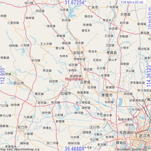
Hujindian GPS coordinates[2]
31° 4' 19.992" North, 113° 39' 29.232" East
| Map corner | latitude | longitude |
|---|---|---|
| Upper-left | 31.67254°, | 112.955° |
| Center: | 31.07222°, | 113.65812° |
| Lower-right: | 30.46808°, | 114.36125° |
| Map W x H: | 133.9×133.9 km | = 83.2×83.2mi |
| max Lat: | 53.31946° ⇑44.6% North |
| Hujindian: | 31.07222° |
| min Lat: | ⇓55.4% South 18.22056° |
| min Long | Hujindian | max Long |
| 75.07348° | 113.65812° | 134.28917° |
| W 46.7%⇐ | ⇒53.3% E |
Elevation
Elevation of Hujindian is 34 m = 112 ft, and this is 450.8 m = 1479 ft below average elevation for this country.
| Max E: |
5622 m = 18445 ft | 76.2% |
| Avg. | 484.8 m = 1591 ft | |
| Hujindian | 34 m = 112 ft | |
Min E: |
-3 m = -10 ft | 23.8% |
See also: China elevation on elevation.city.
Geographical zone
Hujindian is located in North temperate zone (between Tropic of Cancer and the Arctic Circle). Distance of this Northern Tropic circle is 849 km =527.5 mi to South.| Distance of | km | miles | from Hujindian |
|---|---|---|---|
| North Pole | 6552.2 | 4071.3 | to North |
| Arctic Circle | 3946.3 | 2452.1 | to North |
| Tropic Cancer | 849 | 527.5 | to South |
| Equator | 3454.9 | 2146.8 | to South |


Nearby cities:
15 places around Hujindian: (largest is in red/bold)
• Chengbei
14.5 km =9 mi,  214°
214°
• Daodian
14.1 km =8.8 mi,  27°
27°
• Dongmafang
17.4 km =10.8 mi,  168°
168°
• Geputan
16 km =9.9 mi,  156°
156°
• Nancheng
15.5 km =9.6 mi,  13°
13°
• Qingminghe
5.1 km =3.2 mi,  144°
144°
• Silipeng
14.8 km =9.2 mi,  197°
197°
• Wuluo
17.3 km =10.7 mi,  125°
125°
• Wupu
14.1 km =8.8 mi,  104°
104°
• Xinzha
5.6 km =3.5 mi,  330°
330°
• Xundian
10.2 km =6.3 mi,  346°
346°
• Yanghe
7.8 km =4.8 mi,  289°
289°
• Yitang
5.1 km =3.2 mi,  59°
59°
• Yunmeng Chengguanzhen
10.3 km =6.4 mi, 96°
• Zengdian
12.2 km =7.6 mi, 60°
Sources, notices
• [Note1] Compared only with cities in China existing in our database
• [Src1] Map data: © OpenStreetMap contributors (CC-BY-SA)
• [Src2] Other city data from geonames.org with taken over terms of usage.
• [Src3] Geographical zone / Annual Mean Temperature by Robert A. Rohde @ Wikipedia
