Yanghe geodata
Yanghe (Hubei) is a seat of a fourth-order administrative division; located in China in Asia/Shanghai (GMT+8) time zone. In our database, there are 1268 cities with bigger population. Compared to other cities in China, 55.5% of cities are located further ↓South; 53.8% of cities are located further →East and 73.7% of cities have higher elevation than Yanghe. Note1


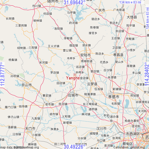
Yanghe GPS coordinates[2]
31° 5' 46.5" North, 113° 34' 51.204" East
| Map corner | latitude | longitude |
|---|---|---|
| Upper-left | 31.69642°, | 112.87777° |
| Center: | 31.09625°, | 113.58089° |
| Lower-right: | 30.49226°, | 114.28402° |
| Map W x H: | 133.9×133.9 km | = 83.2×83.2mi |
| max Lat: | 53.31946° ⇑44.5% North |
| Yanghe: | 31.09625° |
| min Lat: | ⇓55.5% South 18.22056° |
| min Long | Yanghe | max Long |
| 75.07348° | 113.58089° | 134.28917° |
| W 46.2%⇐ | ⇒53.8% E |
Elevation
Elevation of Yanghe is 40 m = 131 ft, and this is 444.8 m = 1459 ft below average elevation for this country.
| Max E: |
5622 m = 18445 ft | 73.7% |
| Avg. | 484.8 m = 1591 ft | |
| Yanghe | 40 m = 131 ft | |
Min E: |
-3 m = -10 ft | 26.3% |
See also: China elevation on elevation.city.
Geographical zone
Yanghe is located in North temperate zone (between Tropic of Cancer and the Arctic Circle). Distance of this Northern Tropic circle is 851.7 km =529.2 mi to South.| Distance of | km | miles | from Yanghe |
|---|---|---|---|
| North Pole | 6549.5 | 4069.7 | to North |
| Arctic Circle | 3943.6 | 2450.4 | to North |
| Tropic Cancer | 851.7 | 529.2 | to South |
| Equator | 3457.6 | 2148.5 | to South |


Nearby cities:
15 places around Yanghe: (largest is in red/bold)
• Chengbei
14.7 km =9.1 mi,  183°
183°
• Chengzhong
17.1 km =10.6 mi,  189°
189°
• Daodian
17 km =10.6 mi,  54°
54°
• Hujindian
7.8 km =4.8 mi,  109°
109°
• Luodian
18.1 km =11.2 mi,  275°
275°
• Muzi
15.2 km =9.4 mi,  347°
347°
• Nancheng
16.6 km =10.3 mi,  41°
41°
• Qingminghe
12.3 km =7.6 mi,  123°
123°
• Silipeng
17 km =10.6 mi,  170°
170°
• Tangdi
15.9 km =9.9 mi,  1°
1°
• Tiandian
14.6 km =9.1 mi,  239°
239°
• Xinzha
5.1 km =3.2 mi,  63°
63°
• Xundian
8.9 km =5.5 mi,  34°
34°
• Yitang
11.8 km =7.3 mi,  90°
90°
• Yunmeng Chengguanzhen
18 km =11.2 mi,  102°
102°
Sources, notices
• [Note1] Compared only with cities in China existing in our database
• [Src1] Map data: © OpenStreetMap contributors (CC-BY-SA)
• [Src2] Other city data from geonames.org with taken over terms of usage.
• [Src3] Geographical zone / Annual Mean Temperature by Robert A. Rohde @ Wikipedia
