Weihe geodata
Weihe (Heilongjiang) is a seat of a fourth-order administrative division; located in China in Asia/Shanghai (GMT+8) time zone. In our database, there are 1268 cities with bigger population. Compared to other cities in China, 93.8% of cities are located further ↓South; 98.1% of cities are located further ←West and 59.1% of cities have lower elevation than Weihe. Note1


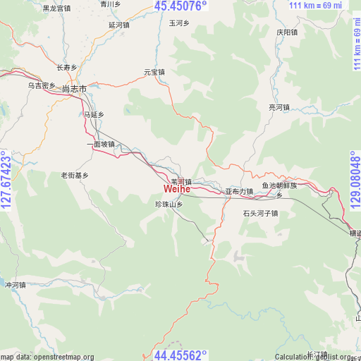
Weihe GPS coordinates[2]
44° 57' 19.26" North, 128° 22' 38.46" East
| Map corner | latitude | longitude |
|---|---|---|
| Upper-left | 45.45076°, | 127.67423° |
| Center: | 44.95535°, | 128.37735° |
| Lower-right: | 44.45562°, | 129.08048° |
| Map W x H: | 110.6×110.6 km | = 68.7×68.7mi |
| max Lat: | 53.31946° ⇑6.2% North |
| Weihe: | 44.95535° |
| min Lat: | ⇓93.8% South 18.22056° |
| min Long | Weihe | max Long |
| 75.07348° | 128.37735° | 134.28917° |
| W 98.1%⇐ | ⇒1.9% E |
Elevation
Elevation of Weihe is 248 m = 814 ft, and this is 236.8 m = 777 ft below average elevation for this country.
| Max E: |
5622 m = 18445 ft | 40.9% |
| Avg. | 484.8 m = 1591 ft | |
| Weihe | 248 m = 814 ft | |
Min E: |
-3 m = -10 ft | 59.1% |
See also: China elevation on elevation.city.
Geographical zone
Weihe is located in North temperate zone (between Tropic of Cancer and the Arctic Circle). Distance of this Northern Tropic circle is 2392.6 km =1486.7 mi to South.| Distance of | km | miles | from Weihe |
|---|---|---|---|
| North Pole | 5008.5 | 3112.1 | to North |
| Arctic Circle | 2402.6 | 1492.9 | to North |
| Tropic Cancer | 2392.6 | 1486.7 | to South |
| Equator | 4998.6 | 3106 | to South |


Nearby cities:
15 places around Weihe: (largest is in red/bold)
• Changshou
49.4 km =30.7 mi,  315°
315°
• Hedong
43.1 km =26.8 mi, 320°
• Laojieji
32.7 km =20.3 mi,  273°
273°
• Lianghe
37.9 km =23.5 mi,  52°
52°
• Shangzhi
42.8 km =26.6 mi,  312°
312°
• Shitouhezi
26 km =16.2 mi,  111°
111°
• Shoushan
54.8 km =34.1 mi,  5°
5°
• Wujimi
51.6 km =32.1 mi,  304°
304°
• Yabuli
18.4 km =11.4 mi,  98°
98°
• Yanhe
51.6 km =32.1 mi,  338°
338°
• Yanshou
55.5 km =34.5 mi,  355°
355°
• Yuanbao
34.6 km =21.5 mi,  346°
346°
• Yuchi
30.4 km =18.9 mi, 95°
• Yuhe
48.6 km =30.2 mi, 359°
• Zhenzhushan
7.9 km =4.9 mi,  207°
207°
Sources, notices
• [Note1] Compared only with cities in China existing in our database
• [Src1] Map data: © OpenStreetMap contributors (CC-BY-SA)
• [Src2] Other city data from geonames.org with taken over terms of usage.
• [Src3] Geographical zone / Annual Mean Temperature by Robert A. Rohde @ Wikipedia
