Taipingzhuang geodata
Taipingzhuang (Liaoning) is a seat of a fourth-order administrative division; located in China in Asia/Shanghai (GMT+8) time zone. In our database, there are 1268 cities with bigger population. Compared to other cities in China, 87% of cities are located further ↓South; 92.5% of cities are located further ←West and 61.5% of cities have lower elevation than Taipingzhuang. Note1


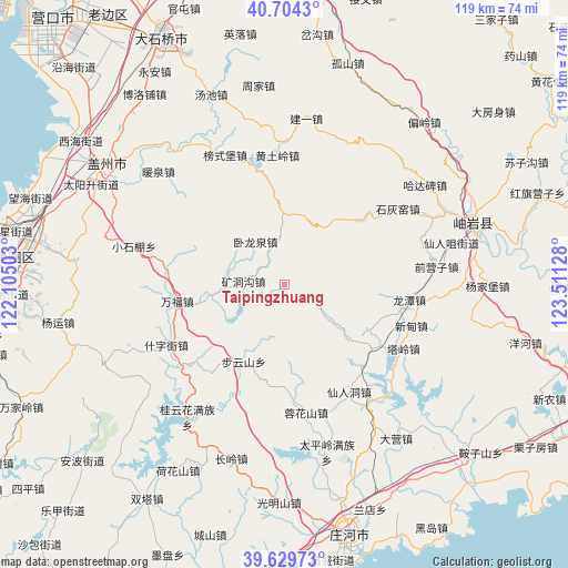
Taipingzhuang GPS coordinates[2]
40° 10' 8.904" North, 122° 48' 29.34" East
| Map corner | latitude | longitude |
|---|---|---|
| Upper-left | 40.7043°, | 122.10503° |
| Center: | 40.16914°, | 122.80815° |
| Lower-right: | 39.62973°, | 123.51128° |
| Map W x H: | 119.5×119.5 km | = 74.3×74.3mi |
| max Lat: | 53.31946° ⇑13% North |
| Taipingzhuang: | 40.16914° |
| min Lat: | ⇓87% South 18.22056° |
| min Long | Taipingzhuang | max Long |
| 75.07348° | 122.80815° | 134.28917° |
| W 92.5%⇐ | ⇒7.5% E |
Elevation
Elevation of Taipingzhuang is 276 m = 906 ft, and this is 208.8 m = 685 ft below average elevation for this country.
| Max E: |
5622 m = 18445 ft | 38.5% |
| Avg. | 484.8 m = 1591 ft | |
| Taipingzhuang | 276 m = 906 ft | |
Min E: |
-3 m = -10 ft | 61.5% |
See also: China elevation on elevation.city.
Geographical zone
Taipingzhuang is located in North temperate zone (between Tropic of Cancer and the Arctic Circle). Distance of this Northern Tropic circle is 1860.5 km =1156.1 mi to South.| Distance of | km | miles | from Taipingzhuang |
|---|---|---|---|
| North Pole | 5540.7 | 3442.8 | to North |
| Arctic Circle | 2934.8 | 1823.6 | to North |
| Tropic Cancer | 1860.5 | 1156.1 | to South |
| Equator | 4466.4 | 2775.3 | to South |


Nearby cities:
15 places around Taipingzhuang: (largest is in red/bold)
• Bangshipu
30.1 km =18.7 mi,  335°
335°
• Buyunshan
18.5 km =11.5 mi,  208°
208°
• Huangtuling
27.2 km =16.9 mi,  357°
357°
• Kuangdonggou
8.8 km =5.5 mi,  273°
273°
• Liangtun
25 km =15.5 mi,  280°
280°
• Lüwang
26.2 km =16.3 mi,  12°
12°
• Qianying
31.7 km =19.7 mi,  92°
92°
• Qianyingzi
32 km =19.9 mi,  83°
83°
• Shihuiyao
29.9 km =18.6 mi,  57°
57°
• Shizijie
29.6 km =18.4 mi,  246°
246°
• Taling
28.8 km =17.9 mi,  116°
116°
• Wanfu
22.5 km =14 mi,  261°
261°
• Wolongquan
11.7 km =7.3 mi,  327°
327°
• Xiangrong
26.4 km =16.4 mi,  96°
96°
• Xindian
26.8 km =16.7 mi, 104°
Sources, notices
• [Note1] Compared only with cities in China existing in our database
• [Src1] Map data: © OpenStreetMap contributors (CC-BY-SA)
• [Src2] Other city data from geonames.org with taken over terms of usage.
• [Src3] Geographical zone / Annual Mean Temperature by Robert A. Rohde @ Wikipedia
