Kuangdonggou geodata
Kuangdonggou (Liaoning) is a seat of a fourth-order administrative division; located in China in Asia/Shanghai (GMT+8) time zone. In our database, there are 1268 cities with bigger population. Compared to other cities in China, 87.1% of cities are located further ↓South; 92.4% of cities are located further ←West and 56.1% of cities have lower elevation than Kuangdonggou. Note1


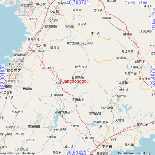
Kuangdonggou GPS coordinates[2]
40° 10' 24.996" North, 122° 42' 15.012" East
| Map corner | latitude | longitude |
|---|---|---|
| Upper-left | 40.70873°, | 122.00105° |
| Center: | 40.17361°, | 122.70417° |
| Lower-right: | 39.63423°, | 123.4073° |
| Map W x H: | 119.5×119.5 km | = 74.3×74.3mi |
| max Lat: | 53.31946° ⇑12.9% North |
| Kuangdonggou: | 40.17361° |
| min Lat: | ⇓87.1% South 18.22056° |
| min Long | Kuangdonggou | max Long |
| 75.07348° | 122.70417° | 134.28917° |
| W 92.4%⇐ | ⇒7.6% E |
Elevation
Elevation of Kuangdonggou is 217 m = 712 ft, and this is 267.8 m = 879 ft below average elevation for this country.
| Max E: |
5622 m = 18445 ft | 43.9% |
| Avg. | 484.8 m = 1591 ft | |
| Kuangdonggou | 217 m = 712 ft | |
Min E: |
-3 m = -10 ft | 56.1% |
See also: China elevation on elevation.city.
Geographical zone
Kuangdonggou is located in North temperate zone (between Tropic of Cancer and the Arctic Circle). Distance of this Northern Tropic circle is 1861 km =1156.4 mi to South.| Distance of | km | miles | from Kuangdonggou |
|---|---|---|---|
| North Pole | 5540.2 | 3442.5 | to North |
| Arctic Circle | 2934.3 | 1823.3 | to North |
| Tropic Cancer | 1861 | 1156.4 | to South |
| Equator | 4466.9 | 2775.6 | to South |


Nearby cities:
15 places around Kuangdonggou: (largest is in red/bold)
• Bangshipu
27.1 km =16.8 mi,  352°
352°
• Buyunshan
16.8 km =10.4 mi,  179°
179°
• Gaotun
30.2 km =18.8 mi,  343°
343°
• Huangtuling
27.7 km =17.2 mi,  15°
15°
• Liangtun
16.3 km =10.1 mi,  284°
284°
• Lüwang
28.9 km =18 mi,  29°
29°
• Nuanquan
28.7 km =17.8 mi,  323°
323°
• Shizijie
22.1 km =13.7 mi,  235°
235°
• Taipingzhuang
8.8 km =5.5 mi,  93°
93°
• Tuandian
35.1 km =21.8 mi,  325°
325°
• Wanfu
13.9 km =8.6 mi,  253°
253°
• Weiziyu
34.3 km =21.3 mi,  3°
3°
• Wolongquan
9.8 km =6.1 mi, 15°
• Xutun
32.8 km =20.4 mi,  305°
305°
• Yangshufang
24.3 km =15.1 mi,  288°
288°
Sources, notices
• [Note1] Compared only with cities in China existing in our database
• [Src1] Map data: © OpenStreetMap contributors (CC-BY-SA)
• [Src2] Other city data from geonames.org with taken over terms of usage.
• [Src3] Geographical zone / Annual Mean Temperature by Robert A. Rohde @ Wikipedia
