Qinghecheng geodata
Qinghecheng (Liaoning) is a seat of a fourth-order administrative division; located in China in Asia/Shanghai (GMT+8) time zone. In our database, there are 1268 cities with bigger population. Compared to other cities in China, 90.1% of cities are located further ↓South; 94.1% of cities are located further ←West and 61% of cities have lower elevation than Qinghecheng. Note1


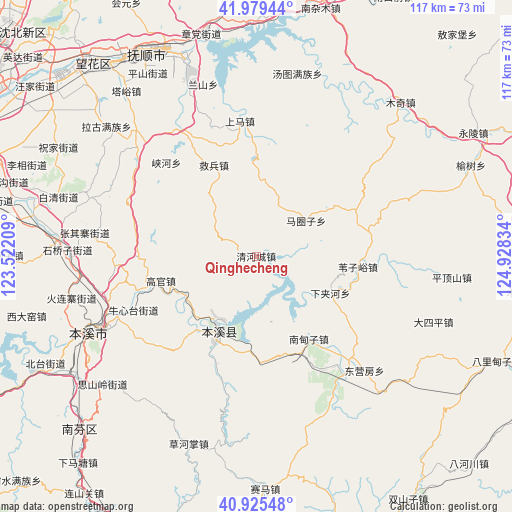
Qinghecheng GPS coordinates[2]
41° 27' 16.56" North, 124° 13' 30.756" East
| Map corner | latitude | longitude |
|---|---|---|
| Upper-left | 41.97944°, | 123.52209° |
| Center: | 41.4546°, | 124.22521° |
| Lower-right: | 40.92548°, | 124.92834° |
| Map W x H: | 117.2×117.2 km | = 72.8×72.8mi |
| max Lat: | 53.31946° ⇑9.9% North |
| Qinghecheng: | 41.4546° |
| min Lat: | ⇓90.1% South 18.22056° |
| min Long | Qinghecheng | max Long |
| 75.07348° | 124.22521° | 134.28917° |
| W 94.1%⇐ | ⇒5.9% E |
Elevation
Elevation of Qinghecheng is 271 m = 889 ft, and this is 213.8 m = 701 ft below average elevation for this country.
| Max E: |
5622 m = 18445 ft | 39% |
| Avg. | 484.8 m = 1591 ft | |
| Qinghecheng | 271 m = 889 ft | |
Min E: |
-3 m = -10 ft | 61% |
See also: China elevation on elevation.city.
Geographical zone
Qinghecheng is located in North temperate zone (between Tropic of Cancer and the Arctic Circle). Distance of this Northern Tropic circle is 2003.4 km =1244.9 mi to South.| Distance of | km | miles | from Qinghecheng |
|---|---|---|---|
| North Pole | 5397.7 | 3354 | to North |
| Arctic Circle | 2791.9 | 1734.8 | to North |
| Tropic Cancer | 2003.4 | 1244.9 | to South |
| Equator | 4609.3 | 2864.1 | to South |


Nearby cities:
15 places around Qinghecheng: (largest is in red/bold)
• Benxi
42.6 km =26.5 mi,  244°
244°
• Dongyingfang
36 km =22.4 mi,  136°
136°
• Guanyinge
18.2 km =11.3 mi,  210°
210°
• Hou’an
27.8 km =17.3 mi,  358°
358°
• Jianchang
30.6 km =19 mi, 137°
• Jiubing
23 km =14.3 mi,  335°
335°
• Lanshan
39.8 km =24.7 mi, 344°
• Majuanzi
14.4 km =8.9 mi,  56°
56°
• Nandianzi
22.7 km =14.1 mi,  147°
147°
• Shangma
36.9 km =22.9 mi,  350°
350°
• Tangtu
42.5 km =26.4 mi,  12°
12°
• Tianshifu
24.6 km =15.3 mi, 154°
• Weiziyu
23.4 km =14.5 mi,  95°
95°
• Xiaoshi
19.6 km =12.2 mi, 206°
• Xiayingzi
40.4 km =25.1 mi,  42°
42°
Sources, notices
• [Note1] Compared only with cities in China existing in our database
• [Src1] Map data: © OpenStreetMap contributors (CC-BY-SA)
• [Src2] Other city data from geonames.org with taken over terms of usage.
• [Src3] Geographical zone / Annual Mean Temperature by Robert A. Rohde @ Wikipedia
