Changshun geodata
Changshun (Inner Mongolia) is a seat of a third-order administrative division; located in China in Asia/Shanghai (GMT+8) time zone. In our database, there are 1268 cities with bigger population. Compared to other cities in China, 90.8% of cities are located further ↓South; 51.4% of cities are located further →East and 91.3% of cities have lower elevation than Changshun. Note1


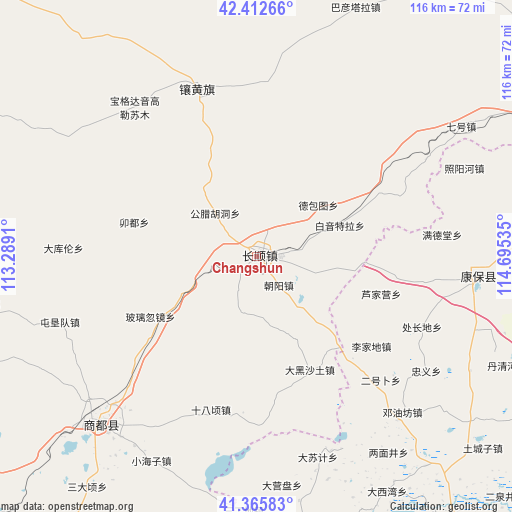
Changshun GPS coordinates[2]
41° 53' 29.004" North, 113° 59' 31.992" East
| Map corner | latitude | longitude |
|---|---|---|
| Upper-left | 42.41266°, | 113.2891° |
| Center: | 41.89139°, | 113.99222° |
| Lower-right: | 41.36583°, | 114.69535° |
| Map W x H: | 116.4×116.4 km | = 72.3×72.3mi |
| max Lat: | 53.31946° ⇑9.2% North |
| Changshun: | 41.89139° |
| min Lat: | ⇓90.8% South 18.22056° |
| min Long | Changshun | max Long |
| 75.07348° | 113.99222° | 134.28917° |
| W 48.6%⇐ | ⇒51.4% E |
Elevation
Elevation of Changshun is 1485 m = 4872 ft, and this is 1000.2 m = 3281 ft above average elevation for this country.
| Max E: |
5622 m = 18445 ft | 8.7% |
| Changshun | 1485 m 4872 ft | |
| Avg. | 484.8 m = 1591 ft | |
Min E: |
-3 m = -10 ft | 91.3% |
See also: China elevation on elevation.city.
Geographical zone
Changshun is located in North temperate zone (between Tropic of Cancer and the Arctic Circle). Distance of this Northern Tropic circle is 2052 km =1275.1 mi to South.| Distance of | km | miles | from Changshun |
|---|---|---|---|
| North Pole | 5349.2 | 3323.8 | to North |
| Arctic Circle | 2743.3 | 1704.6 | to North |
| Tropic Cancer | 2052 | 1275.1 | to South |
| Equator | 4657.9 | 2894.3 | to South |


Nearby cities:
15 places around Changshun: (largest is in red/bold)
• Aguitu
71.9 km =44.7 mi,  259°
259°
• Bahaodi
83.8 km =52.1 mi,  271°
271°
• Baiyin Chagan
83 km =51.6 mi,  234°
234°
• Benhong
91.2 km =56.7 mi,  222°
222°
• Danglang Hudong
92.8 km =57.7 mi,  254°
254°
• Hayan Hudong
75.7 km =47 mi, 229°
• Hongge’ertu
73 km =45.4 mi, 252°
• Jigun Tala
87.1 km =54.1 mi, 263°
• Kangbao
51.7 km =32.1 mi,  95°
95°
• Nanhaoqian
91.6 km =56.9 mi,  181°
181°
• Qitai
53.8 km =33.4 mi, 225°
• Shimenkou
81.4 km =50.6 mi, 224°
• Tumu’ertai
70.5 km =43.8 mi, 265°
• Wulan Hada
72.9 km =45.3 mi, 246°
• Xin Bulag
40.6 km =25.2 mi,  341°
341°
Sources, notices
• [Note1] Compared only with cities in China existing in our database
• [Src1] Map data: © OpenStreetMap contributors (CC-BY-SA)
• [Src2] Other city data from geonames.org with taken over terms of usage.
• [Src3] Geographical zone / Annual Mean Temperature by Robert A. Rohde @ Wikipedia
