Handgai geodata
Handgai (Inner Mongolia) is a seat of a fourth-order administrative division; located in China in Asia/Shanghai (GMT+8) time zone. In our database, there are 1268 cities with bigger population. Compared to other cities in China, 97.9% of cities are located further ↓South; 78.2% of cities are located further ←West and 83.3% of cities have lower elevation than Handgai. Note1


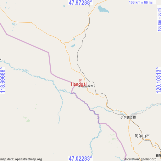
Handgai GPS coordinates[2]
47° 30' 0" North, 119° 24' 0" East
| Map corner | latitude | longitude |
|---|---|---|
| Upper-left | 47.97288°, | 118.69688° |
| Center: | 47.5°, | 119.4° |
| Lower-right: | 47.02283°, | 120.10313° |
| Map W x H: | 105.6×105.6 km | = 65.6×65.6mi |
| max Lat: | 53.31946° ⇑2.1% North |
| Handgai: | 47.5° |
| min Lat: | ⇓97.9% South 18.22056° |
| min Long | Handgai | max Long |
| 75.07348° | 119.4° | 134.28917° |
| W 78.2%⇐ | ⇒21.8% E |
Elevation
Elevation of Handgai is 870 m = 2854 ft, and this is 385.2 m = 1264 ft above average elevation for this country.
| Max E: |
5622 m = 18445 ft | 16.7% |
| Handgai | 870 m 2854 ft | |
| Avg. | 484.8 m = 1591 ft | |
Min E: |
-3 m = -10 ft | 83.3% |
See also: China elevation on elevation.city.
Geographical zone
Handgai is located in North temperate zone (between Tropic of Cancer and the Arctic Circle). Distance of this North polar circle is 2119.7 km =1317.1 mi to North.| Distance of | km | miles | from Handgai |
|---|---|---|---|
| North Pole | 4725.6 | 2936.4 | to North |
| Arctic Circle | 2119.7 | 1317.1 | to North |
| Tropic Cancer | 2675.6 | 1662.5 | to South |
| Equator | 5281.5 | 3281.8 | to South |


Nearby cities:
15 places around Handgai: (largest is in red/bold)
• Alatan Hada
53 km =32.9 mi,  16°
16°
• Amgalang
122.3 km =76 mi,  312°
312°
• Amu Gulang Baolige
133.9 km =83.2 mi,  315°
315°
• Chaihe
143.2 km =89 mi,  87°
87°
• Honghua’erji
96 km =59.7 mi,  26°
26°
• Mingshuihe
136.3 km =84.7 mi,  133°
133°
• Ta’erqi
144.6 km =89.9 mi,  68°
68°
• Wenquan
54.8 km =34.1 mi, 131°
• Wenquan
55.3 km =34.4 mi, 129°
• Wuchagou
108.8 km =67.6 mi,  140°
140°
• Wu’erbu Baolige
68.5 km =42.6 mi,  337°
337°
• Xinbaoli Gedong
143.5 km =89.2 mi, 341°
• Xinbaoli Gexi
111.5 km =69.3 mi,  325°
325°
• Yiminhe
124 km =77.1 mi,  12°
12°
• Yirshi
34.5 km =21.4 mi, 130°
Sources, notices
• [Note1] Compared only with cities in China existing in our database
• [Src1] Map data: © OpenStreetMap contributors (CC-BY-SA)
• [Src2] Other city data from geonames.org with taken over terms of usage.
• [Src3] Geographical zone / Annual Mean Temperature by Robert A. Rohde @ Wikipedia
