Wenquan geodata
Wenquan (Inner Mongolia) is a seat of a third-order administrative division; located in China in Asia/Shanghai (GMT+8) time zone. In our database, there are 1268 cities with bigger population. Compared to other cities in China, 97.3% of cities are located further ↓South; 81.7% of cities are located further ←West and 87.8% of cities have lower elevation than Wenquan. Note1


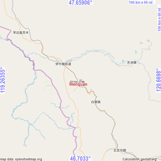
Wenquan GPS coordinates[2]
47° 10' 59.988" North, 119° 58' 0.012" East
| Map corner | latitude | longitude |
|---|---|---|
| Upper-left | 47.65906°, | 119.26355° |
| Center: | 47.18333°, | 119.96667° |
| Lower-right: | 46.7033°, | 120.6698° |
| Map W x H: | 106.3×106.3 km | = 66.1×66.1mi |
| max Lat: | 53.31946° ⇑2.7% North |
| Wenquan: | 47.18333° |
| min Lat: | ⇓97.3% South 18.22056° |
| min Long | Wenquan | max Long |
| 75.07348° | 119.96667° | 134.28917° |
| W 81.7%⇐ | ⇒18.3% E |
Elevation
Elevation of Wenquan is 1170 m = 3839 ft, and this is 685.2 m = 2248 ft above average elevation for this country.
| Max E: |
5622 m = 18445 ft | 12.2% |
| Wenquan | 1170 m 3839 ft | |
| Avg. | 484.8 m = 1591 ft | |
Min E: |
-3 m = -10 ft | 87.8% |
See also: China elevation on elevation.city.
Geographical zone
Wenquan is located in North temperate zone (between Tropic of Cancer and the Arctic Circle). Distance of this North polar circle is 2154.9 km =1339 mi to North.| Distance of | km | miles | from Wenquan |
|---|---|---|---|
| North Pole | 4760.8 | 2958.2 | to North |
| Arctic Circle | 2154.9 | 1339 | to North |
| Tropic Cancer | 2640.4 | 1640.7 | to South |
| Equator | 5246.3 | 3259.9 | to South |


Nearby cities:
15 places around Wenquan: (largest is in red/bold)
• Alatan Hada
90.5 km =56.2 mi,  342°
342°
• Chaihe
109 km =67.7 mi,  67°
67°
• Haduohe
154 km =95.7 mi,  88°
88°
• Handgai
55.3 km =34.4 mi,  309°
309°
• Haoraoshan
126 km =78.3 mi, 88°
• Honghua’erji
120.9 km =75.1 mi,  0°
0°
• Mingshuihe
81.1 km =50.4 mi,  136°
136°
• Shumugou
129.7 km =80.6 mi,  150°
150°
• Sugehe
144.7 km =89.9 mi,  40°
40°
• Ta’erqi
127.8 km =79.4 mi,  46°
46°
• Wenquan
1.6 km =1 mi,  238°
238°
• Wuchagou
55.6 km =34.5 mi, 152°
• Wu’erbu Baolige
120.2 km =74.7 mi,  324°
324°
• Yiminhe
156.7 km =97.4 mi,  354°
354°
• Yirshi
20.9 km =13 mi, 308°
Sources, notices
• [Note1] Compared only with cities in China existing in our database
• [Src1] Map data: © OpenStreetMap contributors (CC-BY-SA)
• [Src2] Other city data from geonames.org with taken over terms of usage.
• [Src3] Geographical zone / Annual Mean Temperature by Robert A. Rohde @ Wikipedia
