Wadi geodata
Wadi (Inner Mongolia) is a seat of a fourth-order administrative division; located in China in Asia/Shanghai (GMT+8) time zone. In our database, there are 1268 cities with bigger population. Compared to other cities in China, 97.5% of cities are located further ↓South; 91.5% of cities are located further ←West and 67.6% of cities have lower elevation than Wadi. Note1


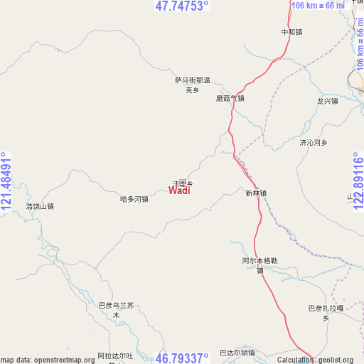
Wadi GPS coordinates[2]
47° 16' 21.36" North, 122° 11' 16.908" East
| Map corner | latitude | longitude |
|---|---|---|
| Upper-left | 47.74753°, | 121.48491° |
| Center: | 47.2726°, | 122.18803° |
| Lower-right: | 46.79337°, | 122.89116° |
| Map W x H: | 106.1×106.1 km | = 65.9×65.9mi |
| max Lat: | 53.31946° ⇑2.5% North |
| Wadi: | 47.2726° |
| min Lat: | ⇓97.5% South 18.22056° |
| min Long | Wadi | max Long |
| 75.07348° | 122.18803° | 134.28917° |
| W 91.5%⇐ | ⇒8.5% E |
Elevation
Elevation of Wadi is 369 m = 1211 ft, and this is 115.8 m = 380 ft below average elevation for this country.
| Max E: |
5622 m = 18445 ft | 32.4% |
| Avg. | 484.8 m = 1591 ft | |
| Wadi | 369 m = 1211 ft | |
Min E: |
-3 m = -10 ft | 67.6% |
See also: China elevation on elevation.city.
Geographical zone
Wadi is located in North temperate zone (between Tropic of Cancer and the Arctic Circle). Distance of this North polar circle is 2145 km =1332.8 mi to North.| Distance of | km | miles | from Wadi |
|---|---|---|---|
| North Pole | 4750.8 | 2952 | to North |
| Arctic Circle | 2145 | 1332.8 | to North |
| Tropic Cancer | 2650.3 | 1646.8 | to South |
| Equator | 5256.2 | 3266.1 | to South |


Nearby cities:
15 places around Wadi: (largest is in red/bold)
• Chaihe
73.4 km =45.6 mi,  295°
295°
• Duibao
65.7 km =40.8 mi,  89°
89°
• Guanmenshan
16.9 km =10.5 mi,  39°
39°
• Haduohe
14.6 km =9.1 mi,  250°
250°
• Haoraoshan
42.4 km =26.3 mi,  260°
260°
• Heshan
70.5 km =43.8 mi,  83°
83°
• Jingxing
67.5 km =41.9 mi,  109°
109°
• Moguqi
28.3 km =17.6 mi,  29°
29°
• Nianzishan
59 km =36.7 mi,  62°
62°
• Qinggis Han
71.9 km =44.7 mi, 42°
• Samajie Ewenkeminzu
28.8 km =17.9 mi,  5°
5°
• Xinlin
19.2 km =11.9 mi,  95°
95°
• Ya’ergenchu
61.4 km =38.2 mi, 30°
• Yongfa
65.9 km =40.9 mi, 101°
• Zhonghe
54 km =33.6 mi, 35°
Sources, notices
• [Note1] Compared only with cities in China existing in our database
• [Src1] Map data: © OpenStreetMap contributors (CC-BY-SA)
• [Src2] Other city data from geonames.org with taken over terms of usage.
• [Src3] Geographical zone / Annual Mean Temperature by Robert A. Rohde @ Wikipedia
