Guanmenshan geodata
Guanmenshan (Inner Mongolia) is a seat of a fourth-order administrative division; located in China in Asia/Shanghai (GMT+8) time zone. In our database, there are 1268 cities with bigger population. Compared to other cities in China, 97.8% of cities are located further ↓South; 91.8% of cities are located further ←West and 65.6% of cities have lower elevation than Guanmenshan. Note1


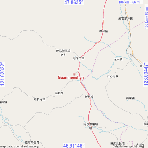
Guanmenshan GPS coordinates[2]
47° 23' 22.668" North, 122° 19' 52.824" East
| Map corner | latitude | longitude |
|---|---|---|
| Upper-left | 47.8635°, | 121.62822° |
| Center: | 47.38963°, | 122.33134° |
| Lower-right: | 46.91146°, | 123.03447° |
| Map W x H: | 105.9×105.9 km | = 65.8×65.8mi |
| max Lat: | 53.31946° ⇑2.2% North |
| Guanmenshan: | 47.38963° |
| min Lat: | ⇓97.8% South 18.22056° |
| min Long | Guanmenshan | max Long |
| 75.07348° | 122.33134° | 134.28917° |
| W 91.8%⇐ | ⇒8.2% E |
Elevation
Elevation of Guanmenshan is 337 m = 1106 ft, and this is 147.8 m = 485 ft below average elevation for this country.
| Max E: |
5622 m = 18445 ft | 34.4% |
| Avg. | 484.8 m = 1591 ft | |
| Guanmenshan | 337 m = 1106 ft | |
Min E: |
-3 m = -10 ft | 65.6% |
See also: China elevation on elevation.city.
Geographical zone
Guanmenshan is located in North temperate zone (between Tropic of Cancer and the Arctic Circle). Distance of this North polar circle is 2131.9 km =1324.7 mi to North.| Distance of | km | miles | from Guanmenshan |
|---|---|---|---|
| North Pole | 4737.8 | 2943.9 | to North |
| Arctic Circle | 2131.9 | 1324.7 | to North |
| Tropic Cancer | 2663.3 | 1654.9 | to South |
| Equator | 5269.2 | 3274.1 | to South |


Nearby cities:
15 places around Guanmenshan: (largest is in red/bold)
• Duibao
56.1 km =34.9 mi,  102°
102°
• Haduohe
30.4 km =18.9 mi,  234°
234°
• Haoraoshan
56.2 km =34.9 mi,  249°
249°
• Heshan
59.3 km =36.8 mi,  94°
94°
• Jingxing
63.6 km =39.5 mi,  123°
123°
• Longjiang
64.1 km =39.8 mi, 95°
• Moguqi
12.1 km =7.5 mi,  14°
14°
• Nianzishan
43.8 km =27.2 mi,  71°
71°
• Qinggis Han
55 km =34.2 mi,  43°
43°
• Samajie Ewenkeminzu
17.6 km =10.9 mi,  333°
333°
• Wadi
16.9 km =10.5 mi,  219°
219°
• Xinlin
17 km =10.6 mi,  151°
151°
• Ya’ergenchu
44.7 km =27.8 mi,  27°
27°
• Yongfa
59.7 km =37.1 mi, 115°
• Zhonghe
37.2 km =23.1 mi, 34°
Sources, notices
• [Note1] Compared only with cities in China existing in our database
• [Src1] Map data: © OpenStreetMap contributors (CC-BY-SA)
• [Src2] Other city data from geonames.org with taken over terms of usage.
• [Src3] Geographical zone / Annual Mean Temperature by Robert A. Rohde @ Wikipedia
