Quchi geodata
Quchi (Chongqing) is a seat of a fourth-order administrative division; located in China in Asia/Shanghai (GMT+8) time zone. In our database, there are 1268 cities with bigger population. Compared to other cities in China, 55.2% of cities are located further ↓South; 72.5% of cities are located further →East and 53.2% of cities have lower elevation than Quchi. Note1


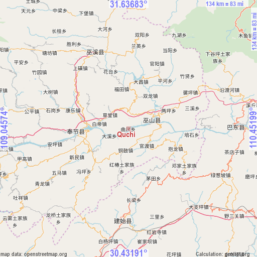
Quchi GPS coordinates[2]
31° 2' 10.608" North, 109° 44' 55.896" East
| Map corner | latitude | longitude |
|---|---|---|
| Upper-left | 31.63683°, | 109.04574° |
| Center: | 31.03628°, | 109.74886° |
| Lower-right: | 30.43191°, | 110.45199° |
| Map W x H: | 134×134 km | = 83.3×83.3mi |
| max Lat: | 53.31946° ⇑44.8% North |
| Quchi: | 31.03628° |
| min Lat: | ⇓55.2% South 18.22056° |
| min Long | Quchi | max Long |
| 75.07348° | 109.74886° | 134.28917° |
| W 27.5%⇐ | ⇒72.5% E |
Elevation
Elevation of Quchi is 190 m = 623 ft, and this is 294.8 m = 967 ft below average elevation for this country.
| Max E: |
5622 m = 18445 ft | 46.8% |
| Avg. | 484.8 m = 1591 ft | |
| Quchi | 190 m = 623 ft | |
Min E: |
-3 m = -10 ft | 53.2% |
See also: China elevation on elevation.city.
Geographical zone
Quchi is located in North temperate zone (between Tropic of Cancer and the Arctic Circle). Distance of this Northern Tropic circle is 845 km =525.1 mi to South.| Distance of | km | miles | from Quchi |
|---|---|---|---|
| North Pole | 6556.2 | 4073.8 | to North |
| Arctic Circle | 3950.3 | 2454.6 | to North |
| Tropic Cancer | 845 | 525.1 | to South |
| Equator | 3450.9 | 2144.3 | to South |


Nearby cities:
15 places around Quchi: (largest is in red/bold)
• Baidi
15.2 km =9.4 mi,  278°
278°
• Caotang
13.3 km =8.3 mi,  296°
296°
• Daxi
11.3 km =7 mi,  248°
248°
• Fenhe
24.3 km =15.1 mi, 297°
• Futian
21 km =13 mi,  350°
350°
• Guandu
12.9 km =8 mi,  133°
133°
• Hongchun
20.7 km =12.9 mi,  189°
189°
• Jianping
16.8 km =10.4 mi,  86°
86°
• Liangping
23 km =14.3 mi,  65°
65°
• Longjing
14.4 km =8.9 mi, 65°
• Miaoyu
21.1 km =13.1 mi,  207°
207°
• Shuanglong
21.6 km =13.4 mi,  35°
35°
• Tonggu
11.5 km =7.1 mi, 188°
• Wushan
13 km =8.1 mi, 68°
• Yongle
23.4 km =14.5 mi,  262°
262°
Sources, notices
• [Note1] Compared only with cities in China existing in our database
• [Src1] Map data: © OpenStreetMap contributors (CC-BY-SA)
• [Src2] Other city data from geonames.org with taken over terms of usage.
• [Src3] Geographical zone / Annual Mean Temperature by Robert A. Rohde @ Wikipedia
