Yongle geodata
Yongle (Chongqing) is a seat of a fourth-order administrative division; located in China in Asia/Shanghai (GMT+8) time zone. In our database, there are 1268 cities with bigger population. Compared to other cities in China, 55% of cities are located further ↓South; 73.9% of cities are located further →East and 77.6% of cities have lower elevation than Yongle. Note1


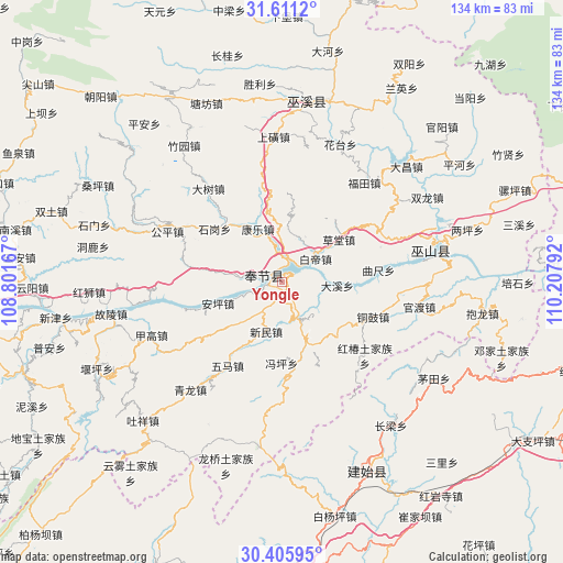
Yongle GPS coordinates[2]
31° 0' 37.728" North, 109° 30' 17.244" East
| Map corner | latitude | longitude |
|---|---|---|
| Upper-left | 31.6112°, | 108.80167° |
| Center: | 31.01048°, | 109.50479° |
| Lower-right: | 30.40595°, | 110.20792° |
| Map W x H: | 134×134 km | = 83.3×83.3mi |
| max Lat: | 53.31946° ⇑45% North |
| Yongle: | 31.01048° |
| min Lat: | ⇓55% South 18.22056° |
| min Long | Yongle | max Long |
| 75.07348° | 109.50479° | 134.28917° |
| W 26.1%⇐ | ⇒73.9% E |
Elevation
Elevation of Yongle is 594 m = 1949 ft, and this is 109.2 m = 358 ft above average elevation for this country.
| Max E: |
5622 m = 18445 ft | 22.4% |
| Yongle | 594 m 1949 ft | |
| Avg. | 484.8 m = 1591 ft | |
Min E: |
-3 m = -10 ft | 77.6% |
See also: China elevation on elevation.city.
Geographical zone
Yongle is located in North temperate zone (between Tropic of Cancer and the Arctic Circle). Distance of this Northern Tropic circle is 842.1 km =523.3 mi to South.| Distance of | km | miles | from Yongle |
|---|---|---|---|
| North Pole | 6559 | 4075.6 | to North |
| Arctic Circle | 3953.1 | 2456.3 | to North |
| Tropic Cancer | 842.1 | 523.3 | to South |
| Equator | 3448 | 2142.5 | to South |


Nearby cities:
15 places around Yongle: (largest is in red/bold)
• Anping
16.1 km =10 mi,  251°
251°
• Baidi
9.7 km =6 mi,  57°
57°
• Caotang
14.4 km =8.9 mi,  52°
52°
• Chang’an
20.6 km =12.8 mi,  165°
165°
• Daxi
12.8 km =8 mi,  95°
95°
• Fengping
19.5 km =12.1 mi,  179°
179°
• Fenhe
14.2 km =8.8 mi,  6°
6°
• Kangle
13.4 km =8.3 mi,  327°
327°
• Miaoyu
20.7 km =12.9 mi,  139°
139°
• Shigang
19.3 km =12 mi,  316°
316°
• Tonggu
23.2 km =14.4 mi,  111°
111°
• Wuma
21.3 km =13.2 mi,  215°
215°
• Xinmin
12.4 km =7.7 mi,  196°
196°
• Yanwan
20.7 km =12.9 mi, 6°
• Yong’an
4.5 km =2.8 mi,  284°
284°
Sources, notices
• [Note1] Compared only with cities in China existing in our database
• [Src1] Map data: © OpenStreetMap contributors (CC-BY-SA)
• [Src2] Other city data from geonames.org with taken over terms of usage.
• [Src3] Geographical zone / Annual Mean Temperature by Robert A. Rohde @ Wikipedia
