Nayun geodata
Nayun (Yunnan) is a seat of a third-order administrative division; located in China in Asia/Shanghai (GMT+8) time zone. In our database, there are 1268 cities with bigger population. Compared to other cities in China, 96.7% of cities are located further ↑North; 94.8% of cities are located further →East and 85.6% of cities have lower elevation than Nayun. Note1


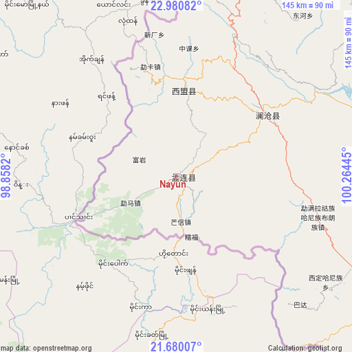
Nayun GPS coordinates[2]
22° 19' 55.056" North, 99° 33' 40.752" East
| Map corner | latitude | longitude |
|---|---|---|
| Upper-left | 22.98082°, | 98.8582° |
| Center: | 22.33196°, | 99.56132° |
| Lower-right: | 21.68007°, | 100.26445° |
| Map W x H: | 144.6×144.6 km | = 89.9×89.9mi |
| max Lat: | 53.31946° ⇑96.7% North |
| Nayun: | 22.33196° |
| min Lat: | ⇓3.3% South 18.22056° |
| min Long | Nayun | max Long |
| 75.07348° | 99.56132° | 134.28917° |
| W 5.2%⇐ | ⇒94.8% E |
Elevation
Elevation of Nayun is 1020 m = 3346 ft, and this is 535.2 m = 1756 ft above average elevation for this country.
| Max E: |
5622 m = 18445 ft | 14.4% |
| Nayun | 1020 m 3346 ft | |
| Avg. | 484.8 m = 1591 ft | |
Min E: |
-3 m = -10 ft | 85.6% |
See also: China elevation on elevation.city.
Geographical zone
Nayun is located in North Torrid zone (between Equator and Tropic of Cancer). Distance of this Northern Tropic circle is 122.8 km =76.3 mi to North.| Distance of | km | miles | from Nayun |
|---|---|---|---|
| North Pole | 7524 | 4675.2 | to North |
| Arctic Circle | 4918.1 | 3056 | to North |
| Tropic Cancer | 122.8 | 76.3 | to North |
| Equator | 2483.1 | 1542.9 | to South |


Nearby cities:
15 places around Nayun: (largest is in red/bold)
• Aihua
238.2 km =148 mi,  13°
13°
• Dedang
189.7 km =117.9 mi,  350°
350°
• Gengma
133.8 km =83.1 mi, 351°
• Jinghong
126.6 km =78.7 mi,  107°
107°
• Liushun
123.9 km =77 mi,  74°
74°
• Mengdong
99.3 km =61.7 mi,  338°
338°
• Menghai
94.6 km =58.8 mi,  116°
116°
• Mengla
226.6 km =140.8 mi, 115°
• Menglang
44.1 km =27.4 mi,  54°
54°
• Mengmeng
128.4 km =79.8 mi, 11°
• Mengsuo
30 km =18.6 mi,  358°
358°
• Nansan
180.3 km =112 mi,  334°
334°
• Ning’er
170.6 km =106 mi,  62°
62°
• Simao
153.8 km =95.6 mi, 70°
• Weiyuan
170.8 km =106.1 mi,  42°
42°
Sources, notices
• [Note1] Compared only with cities in China existing in our database
• [Src1] Map data: © OpenStreetMap contributors (CC-BY-SA)
• [Src2] Other city data from geonames.org with taken over terms of usage.
• [Src3] Geographical zone / Annual Mean Temperature by Robert A. Rohde @ Wikipedia
