Jinghong geodata
Jinghong (Yunnan) is a populated place; located in China in Asia/Shanghai (GMT+8) time zone. With population of 62,105 people, there are 695 cities with bigger population in this country. Compared to other cities in China, 97.3% of cities are located further ↑North; 94% of cities are located further →East and 77.9% of cities have lower elevation than Jinghong. Note1


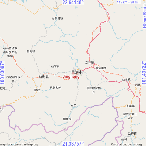
Jinghong GPS coordinates[2]
21° 59' 27.672" North, 100° 44' 2.724" East
| Map corner | latitude | longitude |
|---|---|---|
| Upper-left | 22.64148°, | 100.03097° |
| Center: | 21.99102°, | 100.73409° |
| Lower-right: | 21.33757°, | 101.43722° |
| Map W x H: | 145×145 km | = 90.1×90.1mi |
| max Lat: | 53.31946° ⇑97.3% North |
| Jinghong: | 21.99102° |
| min Lat: | ⇓2.7% South 18.22056° |
| min Long | Jinghong | max Long |
| 75.07348° | 100.73409° | 134.28917° |
| W 6%⇐ | ⇒94% E |
Elevation
Elevation of Jinghong is 611 m = 2005 ft, and this is 126.2 m = 414 ft above average elevation for this country.
| Max E: |
5622 m = 18445 ft | 22.1% |
| Jinghong | 611 m 2005 ft | |
| Avg. | 484.8 m = 1591 ft | |
Min E: |
-3 m = -10 ft | 77.9% |
See also: Jinghong elevation on elevation.city.
Geographical zone
Jinghong is located in North Torrid zone (between Equator and Tropic of Cancer). Distance of this Northern Tropic circle is 160.7 km =99.9 mi to North.| Distance of | km | miles | from Jinghong |
|---|---|---|---|
| North Pole | 7561.9 | 4698.7 | to North |
| Arctic Circle | 4956 | 3079.5 | to North |
| Tropic Cancer | 160.7 | 99.9 | to North |
| Equator | 2445.2 | 1519.4 | to South |


Nearby cities:
15 places around Jinghong: (largest is in red/bold)
• Daxing
203.3 km =126.3 mi,  57°
57°
• Lianzhu
186.7 km =116 mi,  32°
32°
• Lijiang
218.7 km =135.9 mi,  36°
36°
• Liushun
70.8 km =44 mi,  359°
359°
• Mengdong
204.1 km =126.8 mi,  309°
309°
• Menghai
36.3 km =22.6 mi,  263°
263°
• Mengla
102.4 km =63.6 mi,  124°
124°
• Menglang
105.9 km =65.8 mi, 306°
• Menglie
132.7 km =82.5 mi, 61°
• Mengmeng
189.7 km =117.9 mi,  329°
329°
• Mengsuo
139.4 km =86.6 mi,  299°
299°
• Nayun
126.6 km =78.7 mi,  287°
287°
• Ning’er
120.8 km =75.1 mi,  14°
14°
• Simao
92.1 km =57.2 mi,  15°
15°
• Weiyuan
164.3 km =102.1 mi, 358°
Sources, notices
• [Note1] Compared only with cities in China existing in our database
• [Src1] Map data: © OpenStreetMap contributors (CC-BY-SA)
• [Src2] Other city data from geonames.org with taken over terms of usage.
• [Src3] Geographical zone / Annual Mean Temperature by Robert A. Rohde @ Wikipedia
