Guangsheng geodata
Guangsheng (Sichuan) is a seat of a fourth-order administrative division; located in China in Asia/Shanghai (GMT+8) time zone. In our database, there are 1268 cities with bigger population. Compared to other cities in China, 52.4% of cities are located further ↓South; 90.7% of cities are located further →East and 77% of cities have lower elevation than Guangsheng. Note1


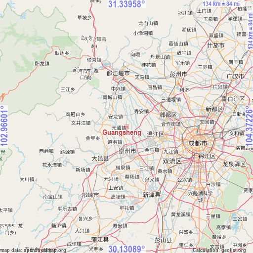
Guangsheng GPS coordinates[2]
30° 44' 13.668" North, 103° 40' 8.868" East
| Map corner | latitude | longitude |
|---|---|---|
| Upper-left | 31.33958°, | 102.96601° |
| Center: | 30.73713°, | 103.66913° |
| Lower-right: | 30.13089°, | 104.37226° |
| Map W x H: | 134.4×134.4 km | = 83.5×83.5mi |
| max Lat: | 53.31946° ⇑47.6% North |
| Guangsheng: | 30.73713° |
| min Lat: | ⇓52.4% South 18.22056° |
| min Long | Guangsheng | max Long |
| 75.07348° | 103.66913° | 134.28917° |
| W 9.3%⇐ | ⇒90.7% E |
Elevation
Elevation of Guangsheng is 576 m = 1890 ft, and this is 91.2 m = 299 ft above average elevation for this country.
| Max E: |
5622 m = 18445 ft | 23% |
| Guangsheng | 576 m 1890 ft | |
| Avg. | 484.8 m = 1591 ft | |
Min E: |
-3 m = -10 ft | 77% |
See also: China elevation on elevation.city.
Geographical zone
Guangsheng is located in North temperate zone (between Tropic of Cancer and the Arctic Circle). Distance of this Northern Tropic circle is 811.7 km =504.4 mi to South.| Distance of | km | miles | from Guangsheng |
|---|---|---|---|
| North Pole | 6589.4 | 4094.5 | to North |
| Arctic Circle | 3983.5 | 2475.2 | to North |
| Tropic Cancer | 811.7 | 504.4 | to South |
| Equator | 3417.6 | 2123.6 | to South |


Nearby cities:
15 places around Guangsheng: (largest is in red/bold)
• Chengdu
38.8 km =24.1 mi,  101°
101°
• Deyang
80.8 km =50.2 mi,  57°
57°
• Dongsheng
30.2 km =18.8 mi,  126°
126°
• Fangting
64.3 km =40 mi,  47°
47°
• Linqiong
40.9 km =25.4 mi,  209°
209°
• Liucheng
16.6 km =10.3 mi, 104°
• Longquan
60.6 km =37.7 mi,  108°
108°
• Luocheng
64.3 km =40 mi,  65°
65°
• Pitong
21.9 km =13.6 mi, 68°
• Tianpeng
37.9 km =23.5 mi,  42°
42°
• Wujin
38.8 km =24.1 mi,  159°
159°
• Xindu
47.6 km =29.6 mi,  78°
78°
• Xipu
28.8 km =17.9 mi,  85°
85°
• Zhaozhen
74.4 km =46.2 mi, 79°
• Zitong
3 km =1.9 mi, 61°
Sources, notices
• [Note1] Compared only with cities in China existing in our database
• [Src1] Map data: © OpenStreetMap contributors (CC-BY-SA)
• [Src2] Other city data from geonames.org with taken over terms of usage.
• [Src3] Geographical zone / Annual Mean Temperature by Robert A. Rohde @ Wikipedia
