Chaoyang geodata
Chaoyang (Jiangxi) is a seat of a fourth-order administrative division; located in China in Asia/Shanghai (GMT+8) time zone. In our database, there are 1268 cities with bigger population. Compared to other cities in China, 70.2% of cities are located further ↑North; 70.9% of cities are located further ←West and 59.9% of cities have higher elevation than Chaoyang. Note1


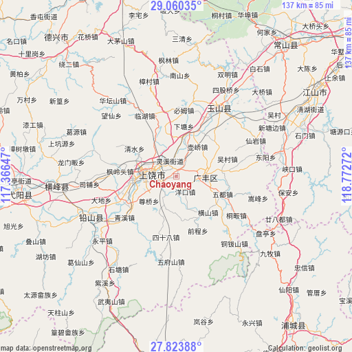
Chaoyang GPS coordinates[2]
28° 26' 38.112" North, 118° 4' 10.524" East
| Map corner | latitude | longitude |
|---|---|---|
| Upper-left | 29.06035°, | 117.36647° |
| Center: | 28.44392°, | 118.06959° |
| Lower-right: | 27.82388°, | 118.77272° |
| Map W x H: | 137.5×137.5 km | = 85.4×85.4mi |
| max Lat: | 53.31946° ⇑70.2% North |
| Chaoyang: | 28.44392° |
| min Lat: | ⇓29.8% South 18.22056° |
| min Long | Chaoyang | max Long |
| 75.07348° | 118.06959° | 134.28917° |
| W 70.9%⇐ | ⇒29.1% E |
Elevation
Elevation of Chaoyang is 99 m = 325 ft, and this is 385.8 m = 1266 ft below average elevation for this country.
| Max E: |
5622 m = 18445 ft | 59.9% |
| Avg. | 484.8 m = 1591 ft | |
| Chaoyang | 99 m = 325 ft | |
Min E: |
-3 m = -10 ft | 40.1% |
See also: China elevation on elevation.city.
Geographical zone
Chaoyang is located in North temperate zone (between Tropic of Cancer and the Arctic Circle). Distance of this Northern Tropic circle is 556.7 km =345.9 mi to South.| Distance of | km | miles | from Chaoyang |
|---|---|---|---|
| North Pole | 6844.4 | 4252.9 | to North |
| Arctic Circle | 4238.5 | 2633.7 | to North |
| Tropic Cancer | 556.7 | 345.9 | to South |
| Equator | 3162.7 | 1965.2 | to South |


Nearby cities:
15 places around Chaoyang: (largest is in red/bold)
• Chating
20.2 km =12.6 mi,  241°
241°
• Danan
20.6 km =12.8 mi,  55°
55°
• Dashi
14.7 km =9.1 mi,  108°
108°
• Hengshan
18.8 km =11.7 mi,  138°
138°
• Huanggu
17.5 km =10.9 mi,  330°
330°
• Hufeng
20.1 km =12.5 mi,  36°
36°
• Huqiao
14.5 km =9 mi, 36°
• Lingxi
7.5 km =4.7 mi, 325°
• Shangrao
12.4 km =7.7 mi,  274°
274°
• Shishi
11.4 km =7.1 mi,  304°
304°
• Wangcun
19.9 km =12.4 mi, 329°
• Xiatang
19.3 km =12 mi,  8°
8°
• Xiaxi
11.6 km =7.2 mi,  81°
81°
• Xuri
14.7 km =9.1 mi, 266°
• Yongfeng
14.4 km =8.9 mi,  101°
101°
Sources, notices
• [Note1] Compared only with cities in China existing in our database
• [Src1] Map data: © OpenStreetMap contributors (CC-BY-SA)
• [Src2] Other city data from geonames.org with taken over terms of usage.
• [Src3] Geographical zone / Annual Mean Temperature by Robert A. Rohde @ Wikipedia
