Garmo geodata
Garmo (Tibet) is a seat of a fourth-order administrative division; located in China in Asia/Shanghai (GMT+8) time zone. In our database, there are 1268 cities with bigger population. Compared to other cities in China, 56.7% of cities are located further ↓South; 96.1% of cities are located further →East and 98.5% of cities have lower elevation than Garmo. Note1


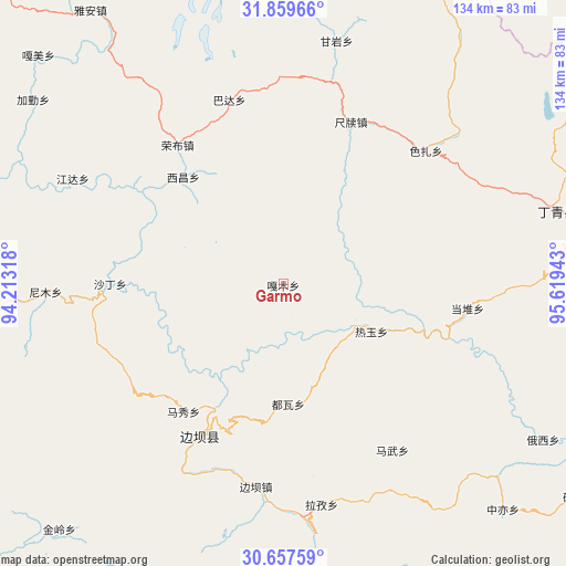
Garmo GPS coordinates[2]
31° 15' 37.944" North, 94° 54' 58.68" East
| Map corner | latitude | longitude |
|---|---|---|
| Upper-left | 31.85966°, | 94.21318° |
| Center: | 31.26054°, | 94.9163° |
| Lower-right: | 30.65759°, | 95.61943° |
| Map W x H: | 133.7×133.7 km | = 83.1×83.1mi |
| max Lat: | 53.31946° ⇑43.3% North |
| Garmo: | 31.26054° |
| min Lat: | ⇓56.7% South 18.22056° |
| min Long | Garmo | max Long |
| 75.07348° | 94.9163° | 134.28917° |
| W 3.9%⇐ | ⇒96.1% E |
Elevation
Elevation of Garmo is 3959 m = 12989 ft, and this is 3474.2 m = 11398 ft above average elevation for this country.
| Max E: |
5622 m = 18445 ft | 1.5% |
| Garmo | 3959 m 12989 ft | |
| Avg. | 484.8 m = 1591 ft | |
Min E: |
-3 m = -10 ft | 98.5% |
See also: China elevation on elevation.city.
Geographical zone
Garmo is located in North temperate zone (between Tropic of Cancer and the Arctic Circle). Distance of this Northern Tropic circle is 869.9 km =540.5 mi to South.| Distance of | km | miles | from Garmo |
|---|---|---|---|
| North Pole | 6531.2 | 4058.3 | to North |
| Arctic Circle | 3925.3 | 2439.1 | to North |
| Tropic Cancer | 869.9 | 540.5 | to South |
| Equator | 3475.8 | 2159.8 | to South |


Nearby cities:
15 places around Garmo: (largest is in red/bold)
• Banbar
48.3 km =30 mi,  189°
189°
• Coka
46 km =28.6 mi,  210°
210°
• Dingqing
65.6 km =40.8 mi,  75°
75°
• Domartang
41.8 km =26 mi, 211°
• Gyamotang
57.7 km =35.9 mi,  58°
58°
• Jamda
56.1 km =34.9 mi,  296°
296°
• Marxog
39.3 km =24.4 mi,  218°
218°
• Mawu
46.7 km =29 mi,  146°
146°
• Nyinmo
55 km =34.2 mi,  268°
268°
• Reyu
23.5 km =14.6 mi,  118°
118°
• Rongbo
42.6 km =26.5 mi,  320°
320°
• Sechang
35.1 km =21.8 mi, 315°
• Shading
40 km =24.9 mi, 269°
• Towa
28.2 km =17.5 mi,  179°
179°
• Xiexiong
68.9 km =42.8 mi, 76°
Sources, notices
• [Note1] Compared only with cities in China existing in our database
• [Src1] Map data: © OpenStreetMap contributors (CC-BY-SA)
• [Src2] Other city data from geonames.org with taken over terms of usage.
• [Src3] Geographical zone / Annual Mean Temperature by Robert A. Rohde @ Wikipedia
