Xiexiong geodata
Xiexiong (Tibet) is a seat of a fourth-order administrative division; located in China in Asia/Shanghai (GMT+8) time zone. In our database, there are 1268 cities with bigger population. Compared to other cities in China, 57.8% of cities are located further ↓South; 96% of cities are located further →East and 98.2% of cities have lower elevation than Xiexiong. Note1


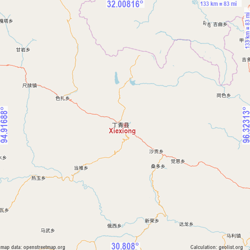
Xiexiong GPS coordinates[2]
31° 24' 36" North, 95° 37' 12" East
| Map corner | latitude | longitude |
|---|---|---|
| Upper-left | 32.00816°, | 94.91688° |
| Center: | 31.41°, | 95.62° |
| Lower-right: | 30.808°, | 96.32313° |
| Map W x H: | 133.4×133.4 km | = 82.9×82.9mi |
| max Lat: | 53.31946° ⇑42.2% North |
| Xiexiong: | 31.41° |
| min Lat: | ⇓57.8% South 18.22056° |
| min Long | Xiexiong | max Long |
| 75.07348° | 95.62° | 134.28917° |
| W 4%⇐ | ⇒96% E |
Elevation
Elevation of Xiexiong is 3801 m = 12470 ft, and this is 3316.2 m = 10880 ft above average elevation for this country.
| Max E: |
5622 m = 18445 ft | 1.8% |
| Xiexiong | 3801 m 12470 ft | |
| Avg. | 484.8 m = 1591 ft | |
Min E: |
-3 m = -10 ft | 98.2% |
See also: China elevation on elevation.city.
Geographical zone
Xiexiong is located in North temperate zone (between Tropic of Cancer and the Arctic Circle). Distance of this Northern Tropic circle is 886.5 km =550.8 mi to South.| Distance of | km | miles | from Xiexiong |
|---|---|---|---|
| North Pole | 6514.6 | 4048 | to North |
| Arctic Circle | 3908.7 | 2428.8 | to North |
| Tropic Cancer | 886.5 | 550.8 | to South |
| Equator | 3492.5 | 2170.1 | to South |


Nearby cities:
15 places around Xiexiong: (largest is in red/bold)
• Banbar
98.4 km =61.1 mi,  229°
229°
• Dingqing
3.4 km =2.1 mi,  272°
272°
• Garmo
68.9 km =42.8 mi,  256°
256°
• Gaxung
73.1 km =45.4 mi,  2°
2°
• Gyamotang
22.4 km =13.9 mi,  307°
307°
• Jinisai
81.5 km =50.6 mi,  26°
26°
• Jiqu
76.2 km =47.3 mi,  38°
38°
• Mawu
68.8 km =42.8 mi,  216°
216°
• Racaka
85.1 km =52.9 mi,  90°
90°
• Reyu
54 km =33.6 mi,  238°
238°
• Rongbo
95 km =59 mi,  279°
279°
• Samdo
95.5 km =59.3 mi,  103°
103°
• Sechang
91.6 km =56.9 mi, 275°
• Towa
80.2 km =49.8 mi, 236°
• Zito
77.4 km =48.1 mi,  164°
164°
Sources, notices
• [Note1] Compared only with cities in China existing in our database
• [Src1] Map data: © OpenStreetMap contributors (CC-BY-SA)
• [Src2] Other city data from geonames.org with taken over terms of usage.
• [Src3] Geographical zone / Annual Mean Temperature by Robert A. Rohde @ Wikipedia
