Zala geodata
Zala (Tibet) is a seat of a fourth-order administrative division; located in China in Asia/Shanghai (GMT+8) time zone. In our database, there are 1268 cities with bigger population. Compared to other cities in China, 59.9% of cities are located further ↓South; 96.5% of cities are located further →East and 99.1% of cities have lower elevation than Zala. Note1


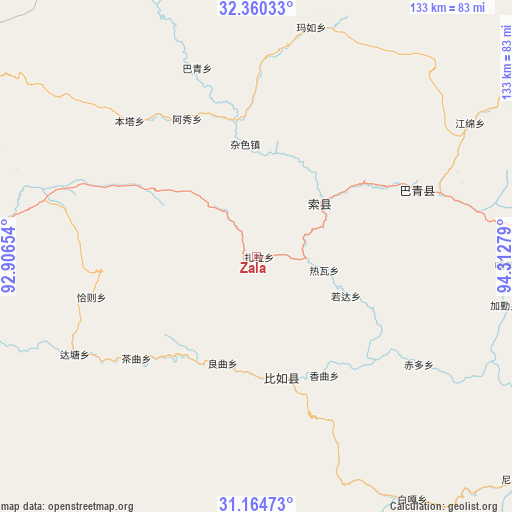
Zala GPS coordinates[2]
31° 45' 52.056" North, 93° 36' 34.776" East
| Map corner | latitude | longitude |
|---|---|---|
| Upper-left | 32.36033°, | 92.90654° |
| Center: | 31.76446°, | 93.60966° |
| Lower-right: | 31.16473°, | 94.31279° |
| Map W x H: | 132.9×132.9 km | = 82.6×82.6mi |
| max Lat: | 53.31946° ⇑40.1% North |
| Zala: | 31.76446° |
| min Lat: | ⇓59.9% South 18.22056° |
| min Long | Zala | max Long |
| 75.07348° | 93.60966° | 134.28917° |
| W 3.5%⇐ | ⇒96.5% E |
Elevation
Elevation of Zala is 4238 m = 13904 ft, and this is 3753.2 m = 12314 ft above average elevation for this country.
| Max E: |
5622 m = 18445 ft | 0.90000000000001% |
| Zala | 4238 m 13904 ft | |
| Avg. | 484.8 m = 1591 ft | |
Min E: |
-3 m = -10 ft | 99.1% |
See also: China elevation on elevation.city.
Geographical zone
Zala is located in North temperate zone (between Tropic of Cancer and the Arctic Circle). Distance of this Northern Tropic circle is 926 km =575.4 mi to South.| Distance of | km | miles | from Zala |
|---|---|---|---|
| North Pole | 6475.2 | 4023.5 | to North |
| Arctic Circle | 3869.3 | 2404.3 | to North |
| Tropic Cancer | 926 | 575.4 | to South |
| Equator | 3531.9 | 2194.6 | to South |


Nearby cities:
15 places around Zala: (largest is in red/bold)
• Biru
31.9 km =19.8 mi,  168°
168°
• Biruxong
40.4 km =25.1 mi,  181°
181°
• Caqu
40.9 km =25.4 mi,  229°
229°
• Chiduo
51.3 km =31.9 mi,  123°
123°
• Dartang
41.4 km =25.7 mi,  63°
63°
• Gamei
63.7 km =39.6 mi,  91°
91°
• Jiaqin
64.3 km =40 mi,  101°
101°
• Lainqu
28.3 km =17.6 mi,  198°
198°
• Laxi
44.9 km =27.9 mi,  67°
67°
• Qiaze
41.6 km =25.8 mi,  261°
261°
• Rawa
20.3 km =12.6 mi, 103°
• Rogda
25.6 km =15.9 mi,  111°
111°
• Xamqu
35.4 km =22 mi,  151°
151°
• Yag La
21.3 km =13.2 mi,  47°
47°
• Zaindainxoi
10.9 km =6.8 mi,  29°
29°
Sources, notices
• [Note1] Compared only with cities in China existing in our database
• [Src1] Map data: © OpenStreetMap contributors (CC-BY-SA)
• [Src2] Other city data from geonames.org with taken over terms of usage.
• [Src3] Geographical zone / Annual Mean Temperature by Robert A. Rohde @ Wikipedia
