Maiba geodata
Maiba (Tibet) is a seat of a fourth-order administrative division; located in China in Asia/Shanghai (GMT+8) time zone. In our database, there are 1268 cities with bigger population. Compared to other cities in China, 54.9% of cities are located further ↓South; 97.7% of cities are located further →East and 99.8% of cities have lower elevation than Maiba. Note1


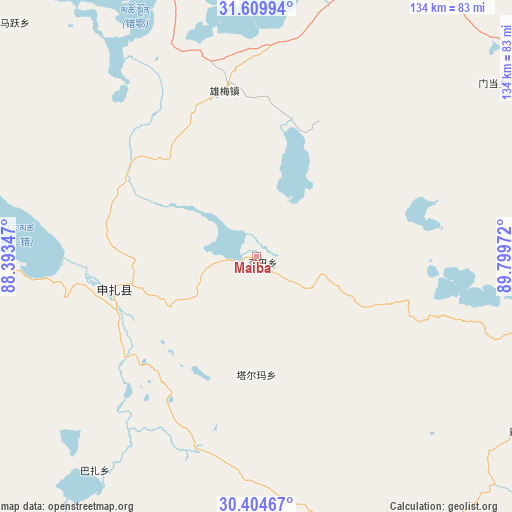
Maiba GPS coordinates[2]
31° 0' 33.156" North, 89° 5' 47.724" East
| Map corner | latitude | longitude |
|---|---|---|
| Upper-left | 31.60994°, | 88.39347° |
| Center: | 31.00921°, | 89.09659° |
| Lower-right: | 30.40467°, | 89.79972° |
| Map W x H: | 134×134 km | = 83.3×83.3mi |
| max Lat: | 53.31946° ⇑45.1% North |
| Maiba: | 31.00921° |
| min Lat: | ⇓54.9% South 18.22056° |
| min Long | Maiba | max Long |
| 75.07348° | 89.09659° | 134.28917° |
| W 2.3%⇐ | ⇒97.7% E |
Elevation
Elevation of Maiba is 4684 m = 15367 ft, and this is 4199.2 m = 13777 ft above average elevation for this country.
| Max E: |
5622 m = 18445 ft | 0.2% |
| Maiba | 4684 m 15367 ft | |
| Avg. | 484.8 m = 1591 ft | |
Min E: |
-3 m = -10 ft | 99.8% |
See also: China elevation on elevation.city.
Geographical zone
Maiba is located in North temperate zone (between Tropic of Cancer and the Arctic Circle). Distance of this Northern Tropic circle is 842 km =523.2 mi to South.| Distance of | km | miles | from Maiba |
|---|---|---|---|
| North Pole | 6559.2 | 4075.7 | to North |
| Arctic Circle | 3953.3 | 2456.5 | to North |
| Tropic Cancer | 842 | 523.2 | to South |
| Equator | 3447.9 | 2142.4 | to South |


Nearby cities:
15 places around Maiba: (largest is in red/bold)
• Baoji
103.4 km =64.2 mi,  90°
90°
• Dana
145.6 km =90.5 mi,  174°
174°
• Deqing
111.9 km =69.5 mi,  118°
118°
• Gyamco
129.6 km =80.5 mi,  176°
176°
• Jiajuedibu
45 km =28 mi,  259°
259°
• Lhabupu
130.3 km =81 mi, 167°
• Maintang
77.1 km =47.9 mi,  54°
54°
• Maqian
126.5 km =78.6 mi,  55°
55°
• Pubu
96.9 km =60.2 mi, 63°
• Pundam
122.9 km =76.4 mi, 179°
• Ratang
145.9 km =90.7 mi, 169°
• Rendui
104 km =64.6 mi, 179°
• Tarma
36.4 km =22.6 mi, 177°
• Xinji
83.9 km =52.1 mi, 123°
• Xungmai
37.7 km =23.4 mi,  348°
348°
Sources, notices
• [Note1] Compared only with cities in China existing in our database
• [Src1] Map data: © OpenStreetMap contributors (CC-BY-SA)
• [Src2] Other city data from geonames.org with taken over terms of usage.
• [Src3] Geographical zone / Annual Mean Temperature by Robert A. Rohde @ Wikipedia
