Baoji geodata
Baoji (Tibet) is a seat of a fourth-order administrative division; located in China in Asia/Shanghai (GMT+8) time zone. In our database, there are 1268 cities with bigger population. Compared to other cities in China, 54.8% of cities are located further ↓South; 97.1% of cities are located further →East and 99.9% of cities have lower elevation than Baoji. Note1


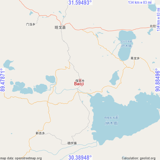
Baoji GPS coordinates[2]
30° 59' 38.796" North, 90° 10' 54.588" East
| Map corner | latitude | longitude |
|---|---|---|
| Upper-left | 31.59493°, | 89.47871° |
| Center: | 30.99411°, | 90.18183° |
| Lower-right: | 30.38948°, | 90.88496° |
| Map W x H: | 134×134 km | = 83.3×83.3mi |
| max Lat: | 53.31946° ⇑45.2% North |
| Baoji: | 30.99411° |
| min Lat: | ⇓54.8% South 18.22056° |
| min Long | Baoji | max Long |
| 75.07348° | 90.18183° | 134.28917° |
| W 2.9%⇐ | ⇒97.1% E |
Elevation
Elevation of Baoji is 4793 m = 15725 ft, and this is 4308.2 m = 14135 ft above average elevation for this country.
| Max E: |
5622 m = 18445 ft | 0.099999999999994% |
| Baoji | 4793 m 15725 ft | |
| Avg. | 484.8 m = 1591 ft | |
Min E: |
-3 m = -10 ft | 99.9% |
See also: China elevation on elevation.city.
Geographical zone
Baoji is located in North temperate zone (between Tropic of Cancer and the Arctic Circle). Distance of this Northern Tropic circle is 840.3 km =522.1 mi to South.| Distance of | km | miles | from Baoji |
|---|---|---|---|
| North Pole | 6560.8 | 4076.7 | to North |
| Arctic Circle | 3955 | 2457.5 | to North |
| Tropic Cancer | 840.3 | 522.1 | to South |
| Equator | 3446.2 | 2141.4 | to South |


Nearby cities:
15 places around Baoji: (largest is in red/bold)
• Beila
76.3 km =47.4 mi,  53°
53°
• Deqing
52.1 km =32.4 mi,  185°
185°
• Dêqên
125.8 km =78.2 mi,  155°
155°
• Jiaqiong
82.5 km =51.3 mi,  26°
26°
• Maiba
103.4 km =64.2 mi,  270°
270°
• Maintang
61.8 km =38.4 mi,  319°
319°
• Maqian
73.8 km =45.9 mi,  0°
0°
• Namaqie
131.8 km =81.9 mi,  62°
62°
• Nyima
84 km =52.2 mi,  83°
83°
• Pubu
47.6 km =29.6 mi,  339°
339°
• Qiangma
126 km =78.3 mi, 29°
• Qinglung
49.7 km =30.9 mi,  68°
68°
• Tarma
108.1 km =67.2 mi,  251°
251°
• Xinji
55.3 km =34.4 mi,  217°
217°
• Xungmai
117.6 km =73.1 mi,  289°
289°
Sources, notices
• [Note1] Compared only with cities in China existing in our database
• [Src1] Map data: © OpenStreetMap contributors (CC-BY-SA)
• [Src2] Other city data from geonames.org with taken over terms of usage.
• [Src3] Geographical zone / Annual Mean Temperature by Robert A. Rohde @ Wikipedia
