Pozhang geodata
Pozhang (Tibet) is a seat of a fourth-order administrative division; located in China in Asia/Shanghai (GMT+8) time zone. In our database, there are 1268 cities with bigger population. Compared to other cities in China, 64.2% of cities are located further ↑North; 96.8% of cities are located further →East and 98% of cities have lower elevation than Pozhang. Note1


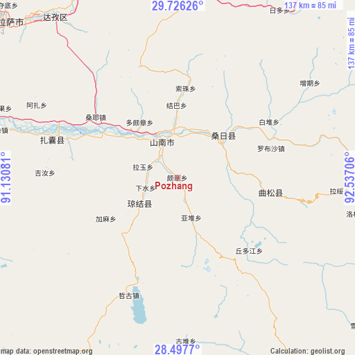
Pozhang GPS coordinates[2]
29° 6' 49.716" North, 91° 50' 2.148" East
| Map corner | latitude | longitude |
|---|---|---|
| Upper-left | 29.72626°, | 91.13081° |
| Center: | 29.11381°, | 91.83393° |
| Lower-right: | 28.4977°, | 92.53706° |
| Map W x H: | 136.6×136.6 km | = 84.9×84.9mi |
| max Lat: | 53.31946° ⇑64.2% North |
| Pozhang: | 29.11381° |
| min Lat: | ⇓35.8% South 18.22056° |
| min Long | Pozhang | max Long |
| 75.07348° | 91.83393° | 134.28917° |
| W 3.2%⇐ | ⇒96.8% E |
Elevation
Elevation of Pozhang is 3679 m = 12070 ft, and this is 3194.2 m = 10480 ft above average elevation for this country.
| Max E: |
5622 m = 18445 ft | 2% |
| Pozhang | 3679 m 12070 ft | |
| Avg. | 484.8 m = 1591 ft | |
Min E: |
-3 m = -10 ft | 98% |
See also: China elevation on elevation.city.
Geographical zone
Pozhang is located in North temperate zone (between Tropic of Cancer and the Arctic Circle). Distance of this Northern Tropic circle is 631.2 km =392.2 mi to South.| Distance of | km | miles | from Pozhang |
|---|---|---|---|
| North Pole | 6769.9 | 4206.6 | to North |
| Arctic Circle | 4164 | 2587.4 | to North |
| Tropic Cancer | 631.2 | 392.2 | to South |
| Equator | 3237.2 | 2011.5 | to South |


Nearby cities:
15 places around Pozhang: (largest is in red/bold)
• Caina
92.7 km =57.6 mi,  293°
293°
• Changzhug
10.7 km =6.6 mi,  325°
325°
• Chaqi
44.6 km =27.7 mi, 290°
• Cuijiu
92.9 km =57.7 mi,  66°
66°
• Dopozhang
26.8 km =16.7 mi, 327°
• Gongbuxue
85.1 km =52.9 mi,  249°
249°
• Jibenggang
91.4 km =56.8 mi,  311°
311°
• Konggar
84.6 km =52.6 mi,  283°
283°
• Layu
17.4 km =10.8 mi, 282°
• Lhasa
92.8 km =57.7 mi, 309°
• Naidong
15.6 km =9.7 mi,  337°
337°
• Ngarrab
73.5 km =45.7 mi,  87°
87°
• Norbusa
37.6 km =23.4 mi, 72°
• Rinang
76.1 km =47.3 mi,  98°
98°
• Sozhug
34.6 km =21.5 mi,  6°
6°
Sources, notices
• [Note1] Compared only with cities in China existing in our database
• [Src1] Map data: © OpenStreetMap contributors (CC-BY-SA)
• [Src2] Other city data from geonames.org with taken over terms of usage.
• [Src3] Geographical zone / Annual Mean Temperature by Robert A. Rohde @ Wikipedia
