Xihe geodata
Xihe (Guangdong) is a seat of a fourth-order administrative division; located in China in Asia/Shanghai (GMT+8) time zone. In our database, there are 1268 cities with bigger population. Compared to other cities in China, 87.2% of cities are located further ↑North; 54% of cities are located further →East and 66.6% of cities have higher elevation than Xihe. Note1


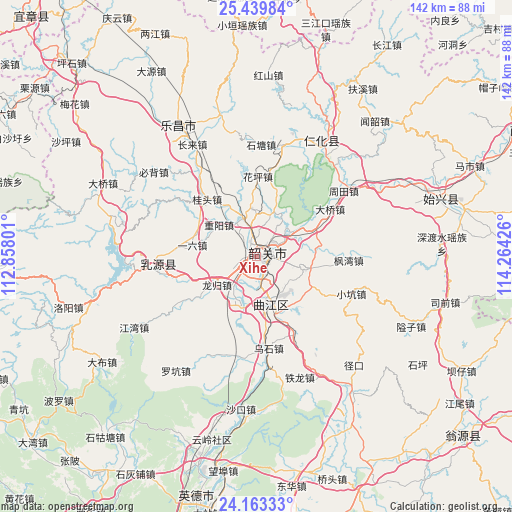
Xihe GPS coordinates[2]
24° 48' 11.628" North, 113° 33' 40.068" East
| Map corner | latitude | longitude |
|---|---|---|
| Upper-left | 25.43984°, | 112.85801° |
| Center: | 24.80323°, | 113.56113° |
| Lower-right: | 24.16333°, | 114.26426° |
| Map W x H: | 141.9×141.9 km | = 88.2×88.2mi |
| max Lat: | 53.31946° ⇑87.2% North |
| Xihe: | 24.80323° |
| min Lat: | ⇓12.8% South 18.22056° |
| min Long | Xihe | max Long |
| 75.07348° | 113.56113° | 134.28917° |
| W 46%⇐ | ⇒54% E |
Elevation
Elevation of Xihe is 66 m = 217 ft, and this is 418.8 m = 1374 ft below average elevation for this country.
| Max E: |
5622 m = 18445 ft | 66.6% |
| Avg. | 484.8 m = 1591 ft | |
| Xihe | 66 m = 217 ft | |
Min E: |
-3 m = -10 ft | 33.4% |
See also: China elevation on elevation.city.
Geographical zone
Xihe is located in North temperate zone (between Tropic of Cancer and the Arctic Circle). Distance of this Northern Tropic circle is 151.9 km =94.4 mi to South.| Distance of | km | miles | from Xihe |
|---|---|---|---|
| North Pole | 7249.2 | 4504.4 | to North |
| Arctic Circle | 4643.3 | 2885.2 | to North |
| Tropic Cancer | 151.9 | 94.4 | to South |
| Equator | 2757.9 | 1713.7 | to South |


Nearby cities:
15 places around Xihe: (largest is in red/bold)
• Baitu
14.2 km =8.8 mi,  199°
199°
• Daqiao
23 km =14.3 mi,  58°
58°
• Datang
13.7 km =8.5 mi,  103°
103°
• Guitou
20.5 km =12.7 mi,  314°
314°
• Huaping
23.4 km =14.5 mi,  2°
2°
• Leyuan
5.7 km =3.5 mi,  158°
158°
• Lishi
11.5 km =7.1 mi,  341°
341°
• Longgui
13.7 km =8.5 mi,  236°
236°
• Maba
13.8 km =8.6 mi, 164°
• Shaoguan
2.3 km =1.4 mi, 99°
• Shiliting
5 km =3.1 mi, 4°
• Xilian
5.4 km =3.4 mi,  208°
208°
• Xinshao
5 km =3.1 mi, 64°
• Yiliu
16.2 km =10.1 mi,  282°
282°
• Zhongyang
13.7 km =8.5 mi, 311°
Sources, notices
• [Note1] Compared only with cities in China existing in our database
• [Src1] Map data: © OpenStreetMap contributors (CC-BY-SA)
• [Src2] Other city data from geonames.org with taken over terms of usage.
• [Src3] Geographical zone / Annual Mean Temperature by Robert A. Rohde @ Wikipedia
