Chang’an geodata
Chang’an (Chongqing) is a seat of a fourth-order administrative division; located in China in Asia/Shanghai (GMT+8) time zone. In our database, there are 1268 cities with bigger population. Compared to other cities in China, 53.2% of cities are located further ↓South; 73.6% of cities are located further →East and 74.9% of cities have lower elevation than Chang’an. Note1


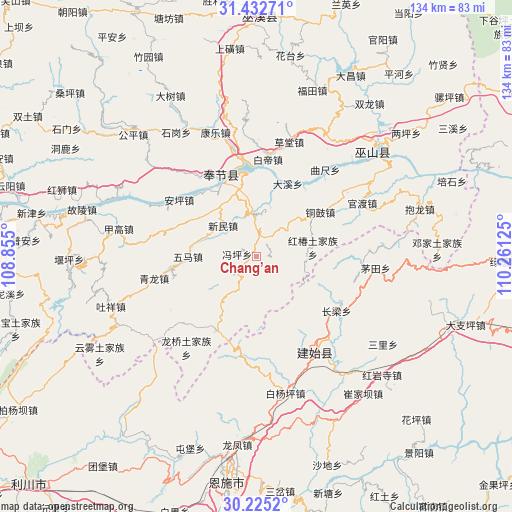
Chang’an GPS coordinates[2]
30° 49' 51.06" North, 109° 33' 29.232" East
| Map corner | latitude | longitude |
|---|---|---|
| Upper-left | 31.43271°, | 108.855° |
| Center: | 30.83085°, | 109.55812° |
| Lower-right: | 30.2252°, | 110.26125° |
| Map W x H: | 134.3×134.3 km | = 83.5×83.5mi |
| max Lat: | 53.31946° ⇑46.8% North |
| Chang’an: | 30.83085° |
| min Lat: | ⇓53.2% South 18.22056° |
| min Long | Chang’an | max Long |
| 75.07348° | 109.55812° | 134.28917° |
| W 26.4%⇐ | ⇒73.6% E |
Elevation
Elevation of Chang’an is 519 m = 1703 ft, and this is 34.2 m = 112 ft above average elevation for this country.
| Max E: |
5622 m = 18445 ft | 25.1% |
| Chang’an | 519 m 1703 ft | |
| Avg. | 484.8 m = 1591 ft | |
Min E: |
-3 m = -10 ft | 74.9% |
See also: China elevation on elevation.city.
Geographical zone
Chang’an is located in North temperate zone (between Tropic of Cancer and the Arctic Circle). Distance of this Northern Tropic circle is 822.2 km =510.9 mi to South.| Distance of | km | miles | from Chang’an |
|---|---|---|---|
| North Pole | 6579 | 4088 | to North |
| Arctic Circle | 3973.1 | 2468.8 | to North |
| Tropic Cancer | 822.2 | 510.9 | to South |
| Equator | 3428.1 | 2130.1 | to South |


Nearby cities:
15 places around Chang’an: (largest is in red/bold)
• Anping
25.1 km =15.6 mi,  306°
306°
• Baidi
25.4 km =15.8 mi,  7°
7°
• Changliang
25.3 km =15.7 mi,  124°
124°
• Daxi
20.2 km =12.6 mi,  22°
22°
• Fengping
5.1 km =3.2 mi,  274°
274°
• Hongchun
14.9 km =9.3 mi,  80°
80°
• Miaoyu
9.4 km =5.8 mi,  63°
63°
• Quchi
29.2 km =18.1 mi,  38°
38°
• Taiyanghe
26.2 km =16.3 mi,  189°
189°
• Tonggu
20.1 km =12.5 mi, 55°
• Wuma
17.5 km =10.9 mi,  278°
278°
• Xinglong
22.1 km =13.7 mi,  209°
209°
• Xinmin
11.9 km =7.4 mi, 312°
• Yongle
20.6 km =12.8 mi,  345°
345°
• Yong’an
23.1 km =14.4 mi,  335°
335°
Sources, notices
• [Note1] Compared only with cities in China existing in our database
• [Src1] Map data: © OpenStreetMap contributors (CC-BY-SA)
• [Src2] Other city data from geonames.org with taken over terms of usage.
• [Src3] Geographical zone / Annual Mean Temperature by Robert A. Rohde @ Wikipedia
