Canggou geodata
Canggou (Chongqing) is a seat of a fourth-order administrative division; located in China in Asia/Shanghai (GMT+8) time zone. In our database, there are 1268 cities with bigger population. Compared to other cities in China, 60.4% of cities are located further ↑North; 80.7% of cities are located further →East and 60.6% of cities have lower elevation than Canggou. Note1


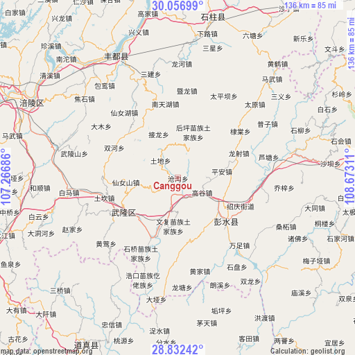
Canggou GPS coordinates[2]
29° 26' 47.58" North, 107° 58' 11.928" East
| Map corner | latitude | longitude |
|---|---|---|
| Upper-left | 30.05699°, | 107.26686° |
| Center: | 29.44655°, | 107.96998° |
| Lower-right: | 28.83242°, | 108.67311° |
| Map W x H: | 136.2×136.2 km | = 84.6×84.6mi |
| max Lat: | 53.31946° ⇑60.4% North |
| Canggou: | 29.44655° |
| min Lat: | ⇓39.6% South 18.22056° |
| min Long | Canggou | max Long |
| 75.07348° | 107.96998° | 134.28917° |
| W 19.3%⇐ | ⇒80.7% E |
Elevation
Elevation of Canggou is 267 m = 876 ft, and this is 217.8 m = 715 ft below average elevation for this country.
| Max E: |
5622 m = 18445 ft | 39.4% |
| Avg. | 484.8 m = 1591 ft | |
| Canggou | 267 m = 876 ft | |
Min E: |
-3 m = -10 ft | 60.6% |
See also: China elevation on elevation.city.
Geographical zone
Canggou is located in North temperate zone (between Tropic of Cancer and the Arctic Circle). Distance of this Northern Tropic circle is 668.2 km =415.2 mi to South.| Distance of | km | miles | from Canggou |
|---|---|---|---|
| North Pole | 6732.9 | 4183.6 | to North |
| Arctic Circle | 4127 | 2564.4 | to North |
| Tropic Cancer | 668.2 | 415.2 | to South |
| Equator | 3274.1 | 2034.4 | to South |


Nearby cities:
15 places around Canggou: (largest is in red/bold)
• Dianshui
21.5 km =13.4 mi,  147°
147°
• Dudu
25 km =15.5 mi,  34°
34°
• Gaogu
10.9 km =6.8 mi,  121°
121°
• Hanjia
25 km =15.5 mi,  132°
132°
• Houping
18.2 km =11.3 mi,  18°
18°
• Huolu
11.1 km =6.9 mi,  238°
238°
• Jiangkou
24.4 km =15.2 mi,  201°
201°
• Jielong
18.2 km =11.3 mi,  336°
336°
• Longshe
25.2 km =15.7 mi,  68°
68°
• Luwu
10.8 km =6.7 mi,  88°
88°
• Ping’an
17 km =10.6 mi,  82°
82°
• Tongzi
12.6 km =7.8 mi,  351°
351°
• Tudi
9.4 km =5.8 mi,  313°
313°
• Wenfu
18.7 km =11.6 mi,  185°
185°
• Xiangkou
26 km =16.2 mi, 240°
Sources, notices
• [Note1] Compared only with cities in China existing in our database
• [Src1] Map data: © OpenStreetMap contributors (CC-BY-SA)
• [Src2] Other city data from geonames.org with taken over terms of usage.
• [Src3] Geographical zone / Annual Mean Temperature by Robert A. Rohde @ Wikipedia
