Enhe Hada geodata
Enhe Hada (Inner Mongolia) is a seat of a fourth-order administrative division; located in China in Asia/Shanghai (GMT+8) time zone. In our database, there are 1268 cities with bigger population. Compared to other cities in China, 100% of cities are located further ↓South; 89.8% of cities are located further ←West and 64.5% of cities have lower elevation than Enhe Hada. Note1


Enhe Hada GPS coordinates[2]
53° 19' 10.056" North, 121° 26' 4.02" East
| Map corner | latitude | longitude |
|---|---|---|
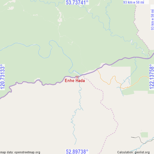
| Upper-left | 53.73741°, | 120.73133° |
| Center: | 53.31946°, | 121.43445° |
| Lower-right: | 52.89738°, | 122.13758° |
| Map W x H: | 93.4×93.4 km | = 58×58mi |
| max Lat: | 53.31946° ⇑0% North |
| Enhe Hada: | 53.31946° |
| min Lat: | ⇓100% South 18.22056° |
| min Long | Enhe Hada | max Long |
| 75.07348° | 121.43445° | 134.28917° |
| W 89.8%⇐ | ⇒10.2% E |
Elevation
Elevation of Enhe Hada is 318 m = 1043 ft, and this is 166.8 m = 547 ft below average elevation for this country.
| Max E: |
5622 m = 18445 ft | 35.5% |
| Avg. | 484.8 m = 1591 ft | |
| Enhe Hada | 318 m = 1043 ft | |
Min E: |
-3 m = -10 ft | 64.5% |
See also: China elevation on elevation.city.
Geographical zone
Enhe Hada is located in North temperate zone (between Tropic of Cancer and the Arctic Circle). Distance of this North polar circle is 1472.6 km =915 mi to North.| Distance of | km | miles | from Enhe Hada |
|---|---|---|---|
| North Pole | 4078.5 | 2534.3 | to North |
| Arctic Circle | 1472.6 | 915 | to North |
| Tropic Cancer | 3322.6 | 2064.6 | to South |
| Equator | 5928.6 | 3683.9 | to South |


Nearby cities:
15 places around Enhe Hada: (largest is in red/bold)
• Alongshan
182.6 km =113.5 mi,  170°
170°
• Aoluguya Ewenke Minzu
134.3 km =83.5 mi,  161°
161°
• Bishui
200.7 km =124.7 mi,  131°
131°
• Cangshan
224.2 km =139.3 mi,  139°
139°
• Hongwei
211.3 km =131.3 mi, 134°
• Huyuan
226.2 km =140.6 mi, 140°
• Jinhe
220.4 km =137 mi,  179°
179°
• Mangui
148.3 km =92.1 mi, 163°
• Mo’er Daoga
233.5 km =145.1 mi,  191°
191°
• Niu’erhe
197.1 km =122.5 mi, 173°
• Qiqian
134.1 km =83.3 mi,  199°
199°
• Shiwei
244.2 km =151.7 mi,  205°
205°
• Tahe
247.2 km =153.6 mi,  116°
116°
• Targen
250.7 km =155.8 mi, 118°
• Xilinji
125.5 km =78 mi,  106°
106°
Sources, notices
• [Note1] Compared only with cities in China existing in our database
• [Src1] Map data: © OpenStreetMap contributors (CC-BY-SA)
• [Src2] Other city data from geonames.org with taken over terms of usage.
• [Src3] Geographical zone / Annual Mean Temperature by Robert A. Rohde @ Wikipedia
