Shang Boingor geodata
Shang Boingor (Qinghai) is a seat of a fourth-order administrative division; located in China in Asia/Shanghai (GMT+8) time zone. In our database, there are 1268 cities with bigger population. Compared to other cities in China, 65.5% of cities are located further ↓South; 94.8% of cities are located further →East and 99.1% of cities have lower elevation than Shang Boingor. Note1


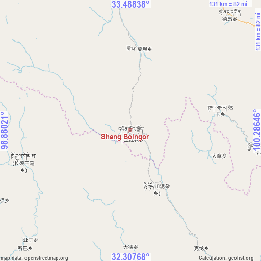
Shang Boingor GPS coordinates[2]
32° 54' 0" North, 99° 34' 59.988" East
| Map corner | latitude | longitude |
|---|---|---|
| Upper-left | 33.48838°, | 98.88021° |
| Center: | 32.9°, | 99.58333° |
| Lower-right: | 32.30768°, | 100.28646° |
| Map W x H: | 131.3×131.3 km | = 81.6×81.6mi |
| max Lat: | 53.31946° ⇑34.5% North |
| Shang Boingor: | 32.9° |
| min Lat: | ⇓65.5% South 18.22056° |
| min Long | Shang Boingor | max Long |
| 75.07348° | 99.58333° | 134.28917° |
| W 5.2%⇐ | ⇒94.8% E |
Elevation
Elevation of Shang Boingor is 4254 m = 13957 ft, and this is 3769.2 m = 12366 ft above average elevation for this country.
| Max E: |
5622 m = 18445 ft | 0.90000000000001% |
| Shang Boingor | 4254 m 13957 ft | |
| Avg. | 484.8 m = 1591 ft | |
Min E: |
-3 m = -10 ft | 99.1% |
See also: China elevation on elevation.city.
Geographical zone
Shang Boingor is located in North temperate zone (between Tropic of Cancer and the Arctic Circle). Distance of this Northern Tropic circle is 1052.2 km =653.8 mi to South.| Distance of | km | miles | from Shang Boingor |
|---|---|---|---|
| North Pole | 6348.9 | 3945 | to North |
| Arctic Circle | 3743 | 2325.8 | to North |
| Tropic Cancer | 1052.2 | 653.8 | to South |
| Equator | 3658.1 | 2273 | to South |


Nearby cities:
15 places around Shang Boingor: (largest is in red/bold)
• Dagkar
46.4 km =28.8 mi,  76°
76°
• Duogongma
96.9 km =60.2 mi, 76°
• Dêrnang
80.4 km =50 mi,  42°
42°
• Gyimkar
65.7 km =40.8 mi,  97°
97°
• Jianshe
88.7 km =55.1 mi,  348°
348°
• Jimai
94.9 km =59 mi,  3°
3°
• Markog
85.9 km =53.4 mi, 76°
• Marzhing
88.1 km =54.7 mi,  59°
59°
• Moba
41.2 km =25.6 mi,  6°
6°
• Sangruma
90.7 km =56.4 mi,  336°
336°
• Seke
99.1 km =61.6 mi,  134°
134°
• Wa’eryi
101 km =62.8 mi, 62°
• Wosai
82.2 km =51.1 mi, 14°
• Xia Boingor
15.6 km =9.7 mi,  135°
135°
• Zhiqin
89.3 km =55.5 mi,  107°
107°
Sources, notices
• [Note1] Compared only with cities in China existing in our database
• [Src1] Map data: © OpenStreetMap contributors (CC-BY-SA)
• [Src2] Other city data from geonames.org with taken over terms of usage.
• [Src3] Geographical zone / Annual Mean Temperature by Robert A. Rohde @ Wikipedia
