Duosong geodata
Duosong (Qinghai) is a seat of a fourth-order administrative division; located in China in Asia/Shanghai (GMT+8) time zone. In our database, there are 1268 cities with bigger population. Compared to other cities in China, 71.7% of cities are located further ↓South; 93.6% of cities are located further →East and 97.7% of cities have lower elevation than Duosong. Note1


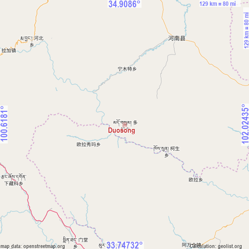
Duosong GPS coordinates[2]
34° 19' 47.892" North, 101° 19' 16.392" East
| Map corner | latitude | longitude |
|---|---|---|
| Upper-left | 34.9086°, | 100.6181° |
| Center: | 34.32997°, | 101.32122° |
| Lower-right: | 33.74732°, | 102.02435° |
| Map W x H: | 129.1×129.1 km | = 80.2×80.2mi |
| max Lat: | 53.31946° ⇑28.3% North |
| Duosong: | 34.32997° |
| min Lat: | ⇓71.7% South 18.22056° |
| min Long | Duosong | max Long |
| 75.07348° | 101.32122° | 134.28917° |
| W 6.4%⇐ | ⇒93.6% E |
Elevation
Elevation of Duosong is 3460 m = 11352 ft, and this is 2975.2 m = 9761 ft above average elevation for this country.
| Max E: |
5622 m = 18445 ft | 2.3% |
| Duosong | 3460 m 11352 ft | |
| Avg. | 484.8 m = 1591 ft | |
Min E: |
-3 m = -10 ft | 97.7% |
See also: China elevation on elevation.city.
Geographical zone
Duosong is located in North temperate zone (between Tropic of Cancer and the Arctic Circle). Distance of this Northern Tropic circle is 1211.2 km =752.6 mi to South.| Distance of | km | miles | from Duosong |
|---|---|---|---|
| North Pole | 6189.9 | 3846.2 | to North |
| Arctic Circle | 3584 | 2227 | to North |
| Tropic Cancer | 1211.2 | 752.6 | to South |
| Equator | 3817.1 | 2371.8 | to South |


Nearby cities:
15 places around Duosong: (largest is in red/bold)
• Awancang
71.2 km =44.2 mi,  150°
150°
• Gyangqai
86.6 km =53.8 mi,  257°
257°
• Kesheng
25.2 km =15.7 mi,  122°
122°
• Mintang
64.6 km =40.1 mi,  204°
204°
• Muxihe
64.1 km =39.8 mi,  186°
186°
• Ningmute
29.3 km =18.2 mi,  2°
2°
• Nyinma
78.1 km =48.5 mi, 117°
• Oula
46.4 km =28.8 mi,  127°
127°
• Oula Xiuma
20.9 km =13 mi,  242°
242°
• Qiakeri
80.3 km =49.9 mi,  9°
9°
• Sai’erlong Xiang
76.8 km =47.7 mi,  76°
76°
• Tuoyema
35.6 km =22.1 mi,  32°
32°
• Xia Zanggor
64.3 km =40 mi, 242°
• Xibusha
85.2 km =52.9 mi,  23°
23°
• Youganning
52.4 km =32.6 mi, 30°
Sources, notices
• [Note1] Compared only with cities in China existing in our database
• [Src1] Map data: © OpenStreetMap contributors (CC-BY-SA)
• [Src2] Other city data from geonames.org with taken over terms of usage.
• [Src3] Geographical zone / Annual Mean Temperature by Robert A. Rohde @ Wikipedia
