Mazongshan geodata
Mazongshan (Gansu) is a seat of a fourth-order administrative division; located in China in Asia/Urumqi (GMT+6) time zone. In our database, there are 1268 cities with bigger population. Compared to other cities in China, 90.7% of cities are located further ↓South; 95.6% of cities are located further →East and 93.3% of cities have lower elevation than Mazongshan. Note1


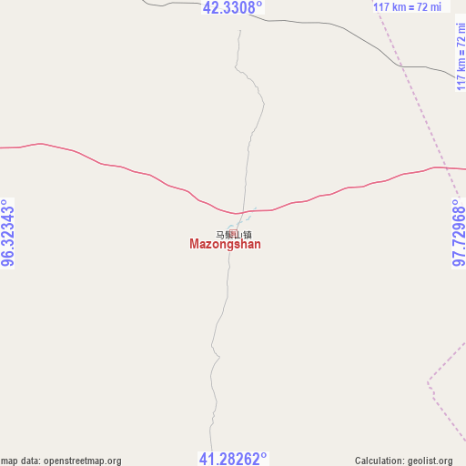
Mazongshan GPS coordinates[2]
41° 48' 31.86" North, 97° 1' 35.58" East
| Map corner | latitude | longitude |
|---|---|---|
| Upper-left | 42.3308°, | 96.32343° |
| Center: | 41.80885°, | 97.02655° |
| Lower-right: | 41.28262°, | 97.72968° |
| Map W x H: | 116.5×116.5 km | = 72.4×72.4mi |
| max Lat: | 53.31946° ⇑9.3% North |
| Mazongshan: | 41.80885° |
| min Lat: | ⇓90.7% South 18.22056° |
| min Long | Mazongshan | max Long |
| 75.07348° | 97.02655° | 134.28917° |
| W 4.4%⇐ | ⇒95.6% E |
Elevation
Elevation of Mazongshan is 1749 m = 5738 ft, and this is 1264.2 m = 4148 ft above average elevation for this country.
| Max E: |
5622 m = 18445 ft | 6.7% |
| Mazongshan | 1749 m 5738 ft | |
| Avg. | 484.8 m = 1591 ft | |
Min E: |
-3 m = -10 ft | 93.3% |
See also: China elevation on elevation.city.
Geographical zone
Mazongshan is located in North temperate zone (between Tropic of Cancer and the Arctic Circle). Distance of this Northern Tropic circle is 2042.8 km =1269.3 mi to South.| Distance of | km | miles | from Mazongshan |
|---|---|---|---|
| North Pole | 5358.4 | 3329.6 | to North |
| Arctic Circle | 2752.5 | 1710.3 | to North |
| Tropic Cancer | 2042.8 | 1269.3 | to South |
| Equator | 4648.7 | 2888.6 | to South |


Nearby cities:
15 places around Mazongshan: (largest is in red/bold)
• Bulongji
147.8 km =91.8 mi,  195°
195°
• Guazhou
187.7 km =116.6 mi,  217°
217°
• Hedong
146.6 km =91.1 mi,  188°
188°
• Huahai
177.7 km =110.4 mi,  160°
160°
• Huancheng
177.2 km =110.1 mi, 216°
• Huangzhawan
158.5 km =98.5 mi,  178°
178°
• Liuhe
155.8 km =96.8 mi, 182°
• Liuyuan
149.4 km =92.8 mi,  238°
238°
• Mazongshan
156.9 km =97.5 mi,  126°
126°
• Qiaozi
179 km =111.2 mi, 202°
• Sandaogou
153.4 km =95.3 mi, 185°
• Xiaxihao
165.9 km =103.1 mi, 177°
• Yaozhanzi
150.3 km =93.4 mi, 189°
• Yuanquan
178.1 km =110.7 mi, 215°
• Yumen
170.2 km =105.8 mi, 175°
Sources, notices
• [Note1] Compared only with cities in China existing in our database
• [Src1] Map data: © OpenStreetMap contributors (CC-BY-SA)
• [Src2] Other city data from geonames.org with taken over terms of usage.
• [Src3] Geographical zone / Annual Mean Temperature by Robert A. Rohde @ Wikipedia
