Jiuheyuan geodata
Jiuheyuan (Hubei) is a seat of a fourth-order administrative division; located in China in Asia/Shanghai (GMT+8) time zone. In our database, there are 1268 cities with bigger population. Compared to other cities in China, 58.5% of cities are located further ↑North; 60.7% of cities are located further →East and 75.3% of cities have higher elevation than Jiuheyuan. Note1


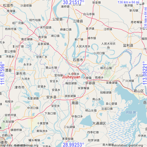
Jiuheyuan GPS coordinates[2]
29° 36' 20.52" North, 112° 22' 44.688" East
| Map corner | latitude | longitude |
|---|---|---|
| Upper-left | 30.21517°, | 111.67596° |
| Center: | 29.6057°, | 112.37908° |
| Lower-right: | 28.99253°, | 113.08221° |
| Map W x H: | 135.9×135.9 km | = 84.4×84.4mi |
| max Lat: | 53.31946° ⇑58.5% North |
| Jiuheyuan: | 29.6057° |
| min Lat: | ⇓41.5% South 18.22056° |
| min Long | Jiuheyuan | max Long |
| 75.07348° | 112.37908° | 134.28917° |
| W 39.3%⇐ | ⇒60.7% E |
Elevation
Elevation of Jiuheyuan is 36 m = 118 ft, and this is 448.8 m = 1472 ft below average elevation for this country.
| Max E: |
5622 m = 18445 ft | 75.3% |
| Avg. | 484.8 m = 1591 ft | |
| Jiuheyuan | 36 m = 118 ft | |
Min E: |
-3 m = -10 ft | 24.7% |
See also: China elevation on elevation.city.
Geographical zone
Jiuheyuan is located in North temperate zone (between Tropic of Cancer and the Arctic Circle). Distance of this Northern Tropic circle is 685.9 km =426.2 mi to South.| Distance of | km | miles | from Jiuheyuan |
|---|---|---|---|
| North Pole | 6715.2 | 4172.6 | to North |
| Arctic Circle | 4109.3 | 2553.4 | to North |
| Tropic Cancer | 685.9 | 426.2 | to South |
| Equator | 3291.8 | 2045.4 | to South |


Nearby cities:
15 places around Jiuheyuan: (largest is in red/bold)
• Diaoguan
25.7 km =16 mi,  68°
68°
• Dongsheng
18.6 km =11.6 mi,  48°
48°
• Gaojimiao
6 km =3.7 mi, 48°
• Gaoling
15.8 km =9.8 mi,  335°
335°
• Huarong Chengguanzhen
19 km =11.8 mi,  120°
120°
• Jiaoqi
29.1 km =18.1 mi,  279°
279°
• Jiaoshanhe
18.9 km =11.7 mi, 72°
• Meitianhu
9.2 km =5.7 mi,  190°
190°
• Nankou
16.9 km =10.5 mi, 343°
• Nanzhou
27.5 km =17.1 mi,  175°
175°
• Ouchi
17.3 km =10.7 mi, 339°
• Renmindayuan
27 km =16.8 mi,  19°
19°
• Tuanshansi
6 km =3.7 mi,  269°
269°
• Xinhe
24.1 km =15 mi,  145°
145°
• Xiulin
12.5 km =7.8 mi,  9°
9°
Sources, notices
• [Note1] Compared only with cities in China existing in our database
• [Src1] Map data: © OpenStreetMap contributors (CC-BY-SA)
• [Src2] Other city data from geonames.org with taken over terms of usage.
• [Src3] Geographical zone / Annual Mean Temperature by Robert A. Rohde @ Wikipedia
